High Nose Peak

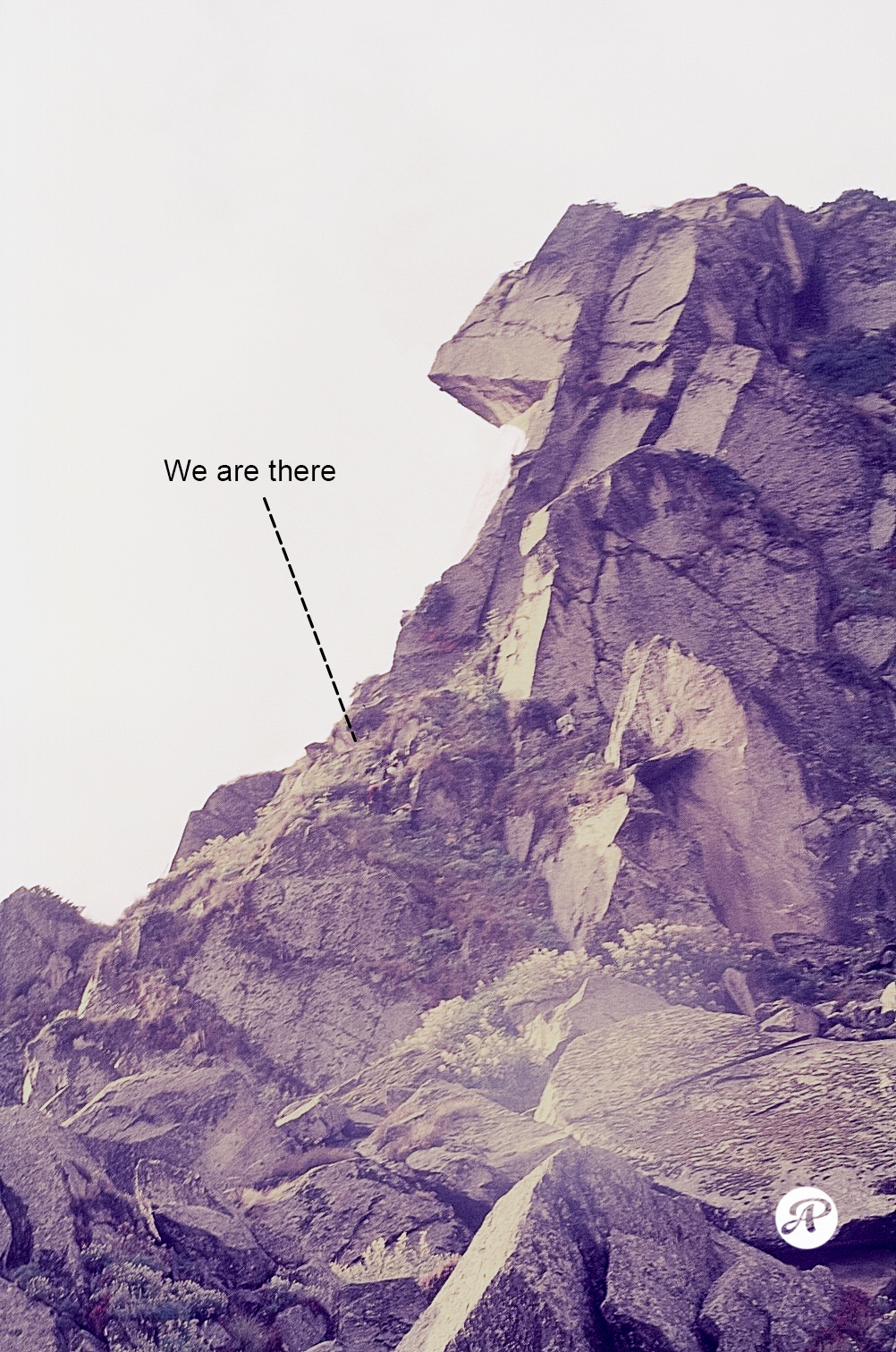
महीना सितंबर का था पर सुबह खासी ठंडी थी। कल्याणी कैम्प धार के ऊपर बनी एक कुटिया में था। कैम्प के बाहर जल रही गीली लकड़ियों का धुआँ पेड़ों की नीचे वाली शाखों पर अटक कर सो गया था। चाय बनने में वक़्त लग रहा था और सूरज देवता उस घाटी से नादारद थे। सामने खड़े भोज के घने जंगल में बहती हवा की आवाज़ आने वाले मौसम की चेतावनी दे रही थी, हल्की धुंध लगी थी हालांकि खतलिंग ग्लेशियर से आने वाली भीलांगना नदी उस सुबह शांत थी। जंगल के बीच से करीब दो मील की खड़ी चढ़ाई पार कर हमे सहस्त्र ताल के नीचे वाली धार तक किसी तरह शाम से पहले पहुंचना था। अगला पड़ाव तड़ी उड़ियार पर होना था जो कल्याणी से करीब 6 मील ऊपर 14000 फुट पर था। कल्याणी और तड़ी उड़ियार के बीच का हिस्सा टूटते पहाड़ और गिरती फिसलती चट्टानों का है ये हमे मालूम था पर ये इल्म नहीं था की ये जनाब (High Nose Peak) उस रोज़ हम सब से खफा थे और अपना इलका पार ना करने देने की ज़िद पर अड़े थे। पहाड़ तो नाराज़ हो सकते हैं पर इंसान नहीं। इन भयानक चट्टानों को पार करना एवरेस्ट वाले हिलरी स्टेप से भी ज्यादा जोखिम वाला काम था। करीब 200 मीटर के इस टुकड़े से पार उतरने में हमे तीन घंटे लगे। दो पोर्टर, मैं और मेरे दो साथी पहले उतर कर पीछे आने वालों को दूर से बता रहे थे कि उतरने का आसान, सीधा और कम खतरे वाला रास्ता कौन सा है। इन साहब की नाक तो देखो ? वाकिया 2003 ट्रेक का है ।  ( सहस्त्र ताल-खतलिंग- मसर ताल-केदार ताल-मयाली पास और ग्लेशियर-वासुकी ताल-केदारनाथ)

Negotiating this granite monster is as difficult, and as risky, as crossing the Hillary’s Step on Mt Everest. One wrong step and that’s it. Plus, this one thumbs its nose at you (look at the shape on top) and makes it mighty difficult to even get a foothold anywhere. Hillary’s Step is just about 40 feet – this obstacle drags on for over 70 feet en route to Sahastra Tal (15,500 ft), a high-altitude glacial lake near Khatling glacier. It took us nearly three hours to clear this. Do you see that ant-like group of humans? Those are my teammates struggling to find a way down while three of us came down another route. This 2003 picture is from a clearing below.
Kanakchauri

Kanakchauri (कनकचौरी) is a tiny little charming village, in the lower Himalayas, about 40 kms west of Rudraprayag. Surrounded by thick pine and deodar forest, this village sits on the slopes of a ridge facing east. A 3.5km hike and a moderate climb, cutting through dense wet forest,  lands one on top of the ridge (9500ft) from where you get the panoramic 360deg views of the Upper Himalayas and the Shivalik range. Short of the Edge on top is the small space to local forest deity ‘Okhali’ (वन देवी ओखली) and further up is the Kartik Swami temple. Walking in the moonlight on a slippery trail is scary but thrilling, the strong freezing breeze is a dampener considering that it had been raining non-stop for five days. The picture looks east awaiting the sunrise at 6.20 am.  Rudraprayag – confluence of Alaknanda and Mandakini  rivers- is the first of the prayag in Chamoli/Rudraprayag district. It was an awesome adventure driving/walking under near white-out and rainy skies from Mana Pass (via Ghastoli-Deotaal) to Niti Pass (via Malari) at India-China border.

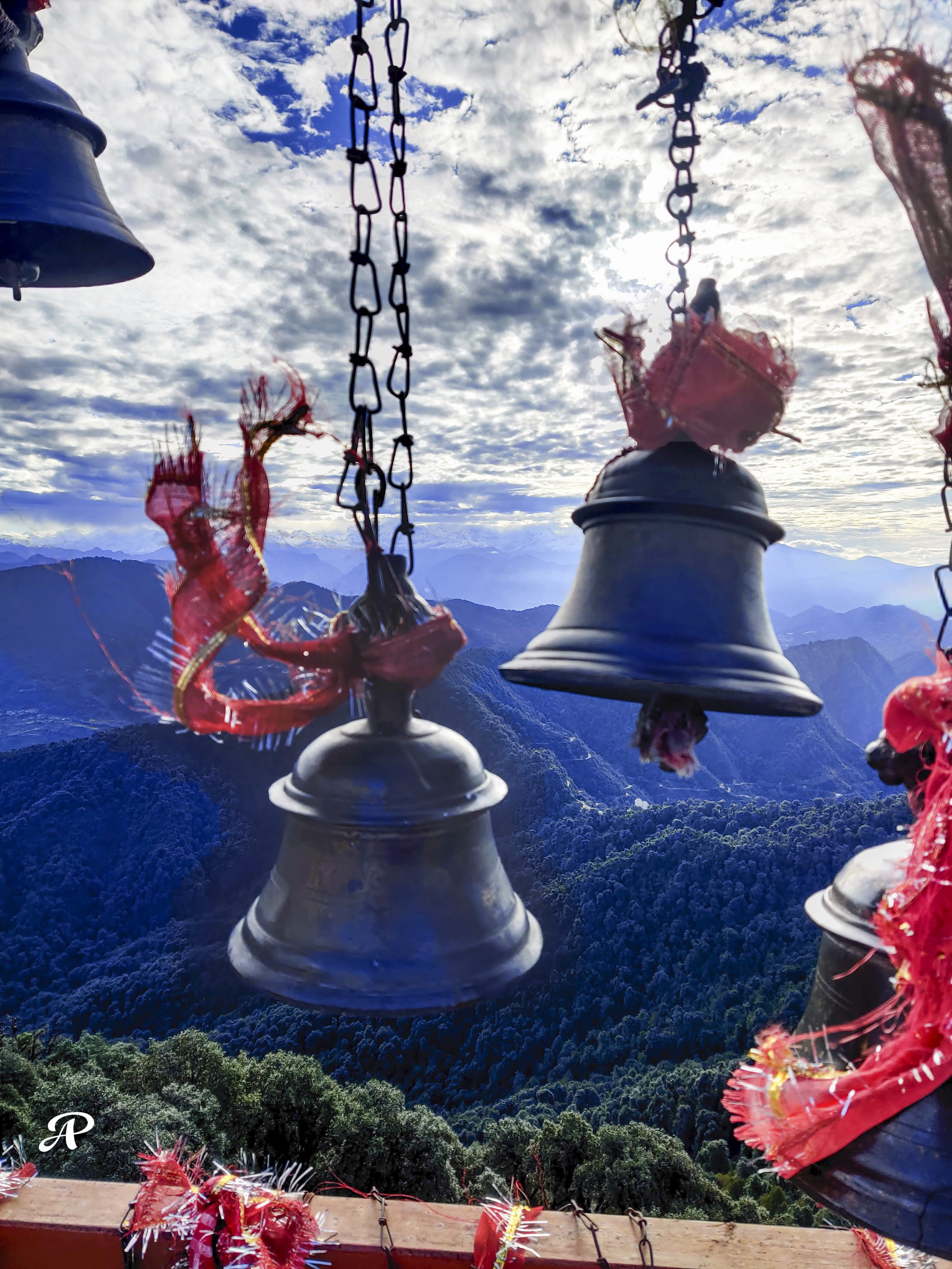
Looking east from the terrace of Kartik Swami temple, Kanakchauri, Rudraprayag. 11 October 2022

Mt Shivling and Mt Meru

दिल्ली तो मेरा ससुराल है सो निभाना ही है पर मायका, मायका पहाड़ है यहाँ आने के लिए पूछना नहीं होता <माउंट शिवलिंग एक्सपीडिशन  डायरी से> मेरु पर्वत थालय सागर और शिवलिंग चोटियें के बीच तपोवन मैदान से 

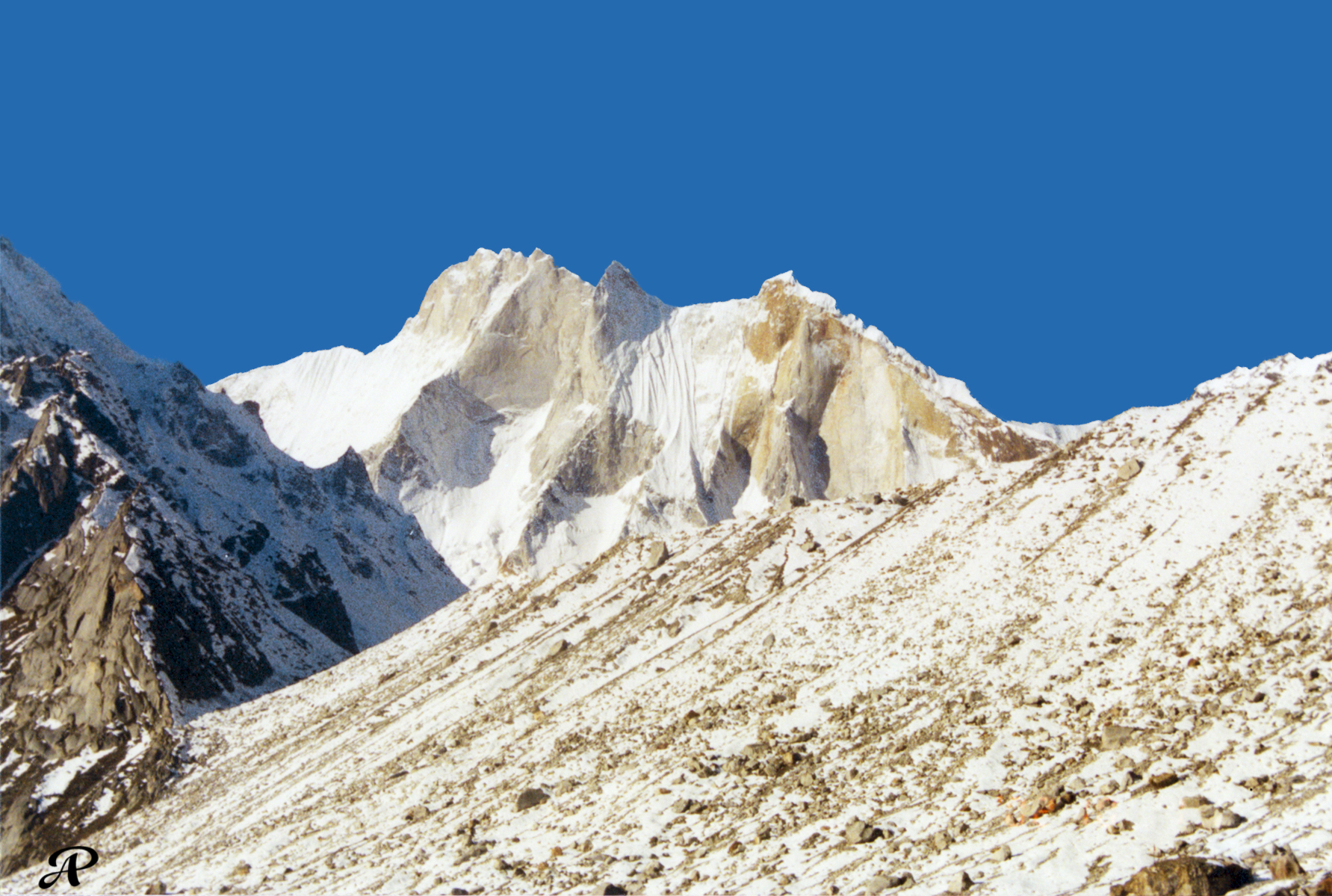
Mt Meru from behind the ridge of Shivling, Tapovan icefield Gangotri

Mt Meru from Tapovan snowfield past Shivling and just above the Meru glacier. Mt Meru lies in between Thalay Sagar and Shivling peaks in Gangotri region. The snow covered  golden ridge that you see in the foreground (right) is exactly behind the Shivling ridge. So one can either skirt Shivling peak along its base or climb over its ridge to get this view. Mt. Meru’s three peaks from left to right: Southern, Central, and Northern. Non-stop snowfall and extremely bad weather hampered our progress and forward movement for days, forcing us to retreat as the supplies depleted and the porters ditched us.

From Mt Shivling expedition diary, 2002. Mt Meru lies between Thalay Sagar and Shivling, and has some highly challenging routes. The name Meru likely originated from the Sanskrit word for “peak”. 

​सहस्तर का फूल

​सहस्रताल टिहरी गढ़वाल की भीलांगना घाटी के विकराल पर्वतों पर स्थित एक भीषण ताल है जो कि बहुत दुर्गम है। स्थानीय ग्रामीण जन सहस्रताल को “सहस्तर” पुकारते हैं और कहते हैं – ‘जर्मन की लड़ाई’, सहस्तर की चढ़ाई । सहस्रताल की यात्रा से लौटने पर एक दिन मैंने यह कामना की:

काश में सहस्तर का फूल होती। कोई हृदयहीन हाथ मुझे तोड़ता तो मेरी डाल के असंख्य महीन कांटे उसमें विषैले डंक मारते। … मेरा पवित्र एकान्त भंग करने वहाँ बेहया भीड़ न होती। कोई इक्का-दुक्का दर्शक वहाँ आता भी तो भीषण डांगरों को पार कर प्रचन्ड वन से गुज़रता एक एक चट्टान पर पैर जमाता, भूख प्यास सहता, अथक श्रम और साहस से हाँफता यहाँ तक पहुंचता और उन ऊँचाइयों पर मुझे खिला पाकर किसी अज्ञात भाव में डूब कर मुझे देखता।

काश में सहस्तर का फूल होती। मैं बिकती नहीं सजती नहीं, मैं किसी फूलदान में कैद न होती, अर्थियों पर न होती, मैं बगीचे में न होती, मैं किसी जूड़े का गहना न होती, मैं किसी के प्रेम का प्रतीक न होती, मैं किसी मन्दिर में न होती।

मैं सहस्तर के भयावह दुरुह तट पर खड़ी ऐन अपनी जड़ों पर होती।

​​ज्योत्स्ना शर्मा​, ​सहस्तर का फूल 

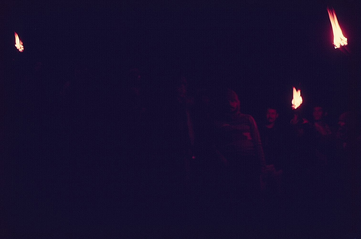
Coming down from Sahastratal after two most stunning but grueling days of the trek. With mashals in hand this an amazing picture where Rastogi ji, Puran Jangpangi can be recognized.