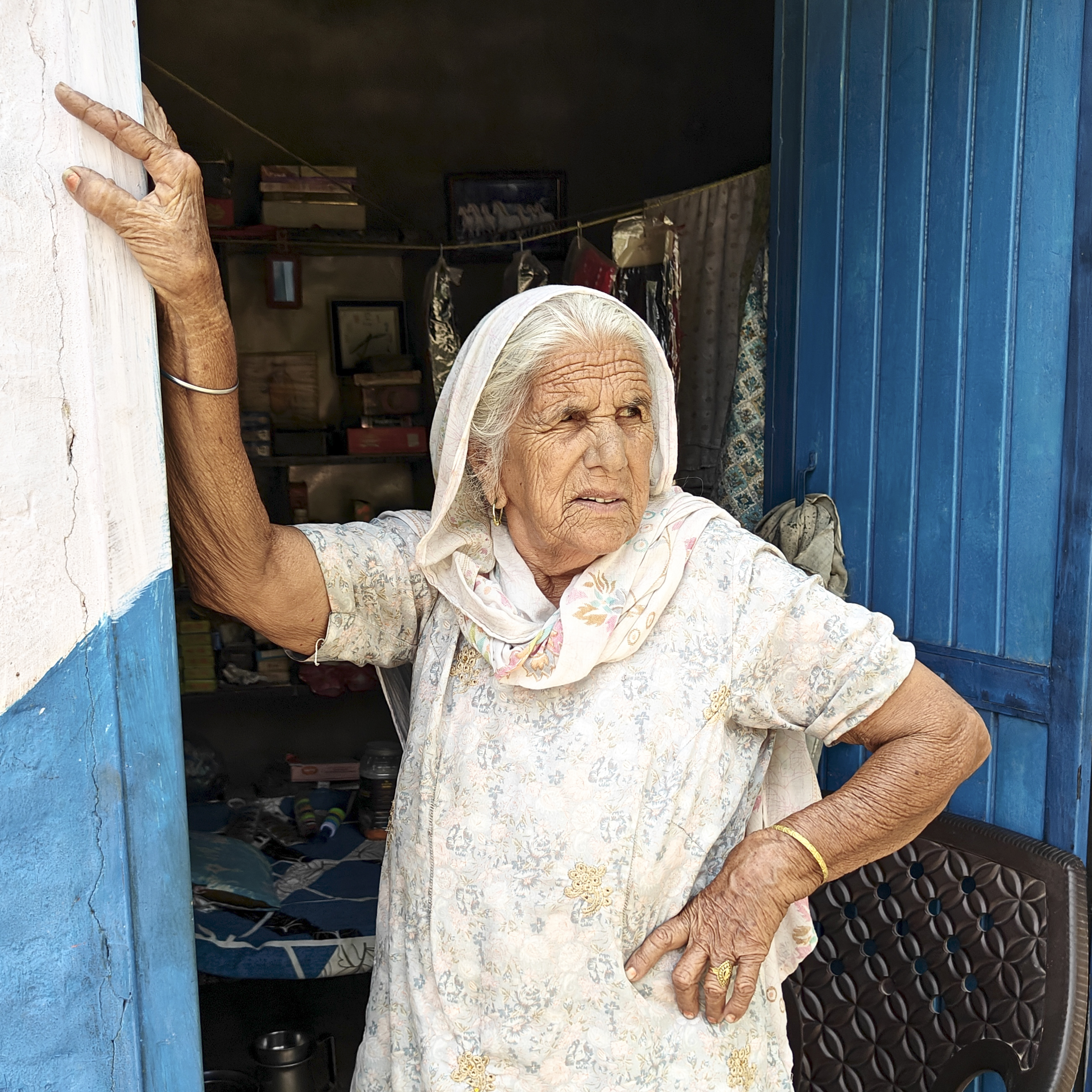
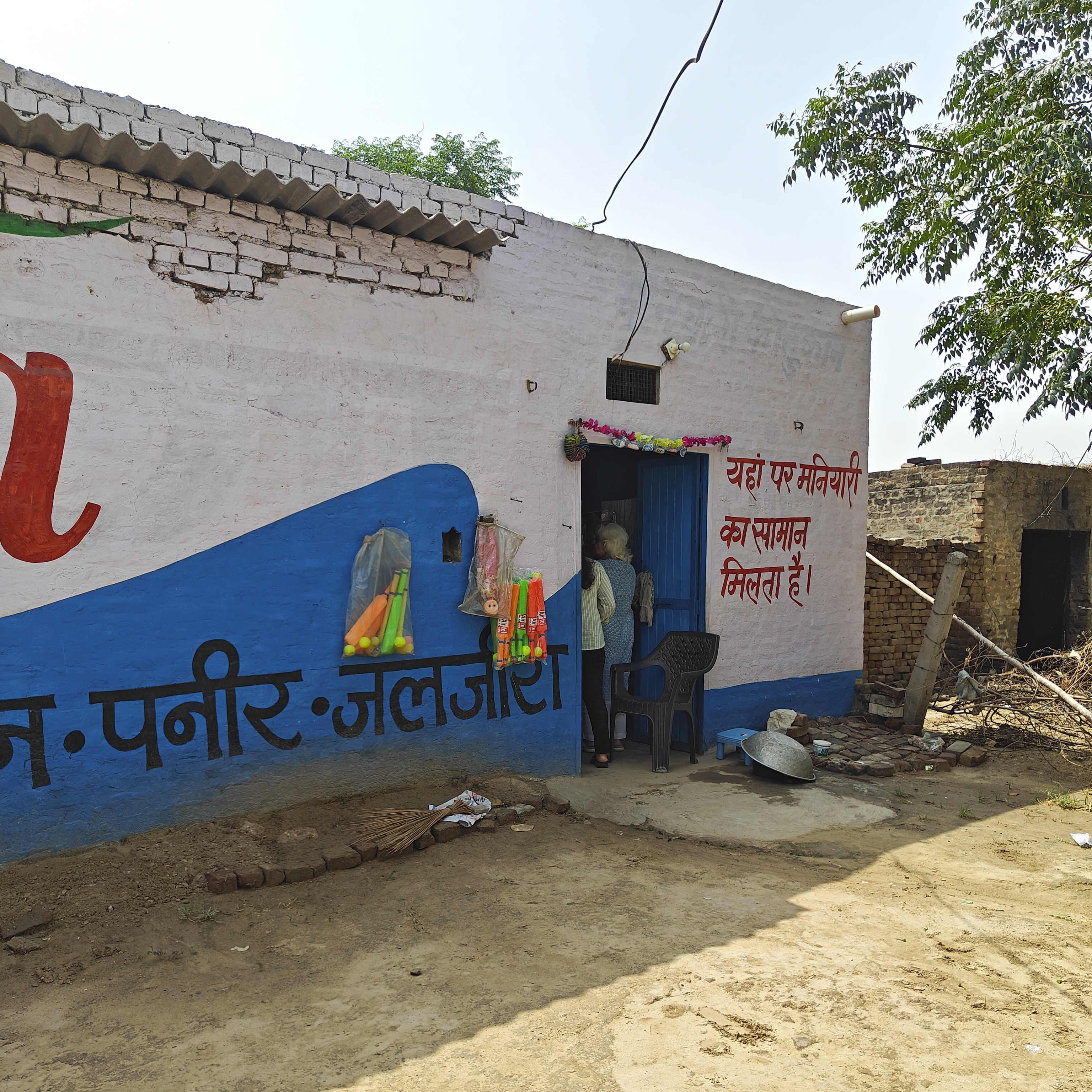
Her name is Raksha Kaur. She stands firm, guarding her precious corner at the tri-junction of Haryana, Punjab, and Rajasthan along NH 54 in Dabwali. In a corner of her house, Raksha runs a tiny store selling ‘Maniyari’ items; maniyari roughly translates to cosmetics and jewellery for women. Face cream, powder, lipstick, plastic pearl strings, rings with colourful stones, ear tops and cheap plastic toys sit on a sagging cot. Across her house two large banyan trees, older than Raksha, stand guard over her brick house and provide much-needed shade in this near-desert land. As a light drizzle and a cool breeze make for a pleasant drive, we witness a quieter battle unfolding at this bustling cross-roads.
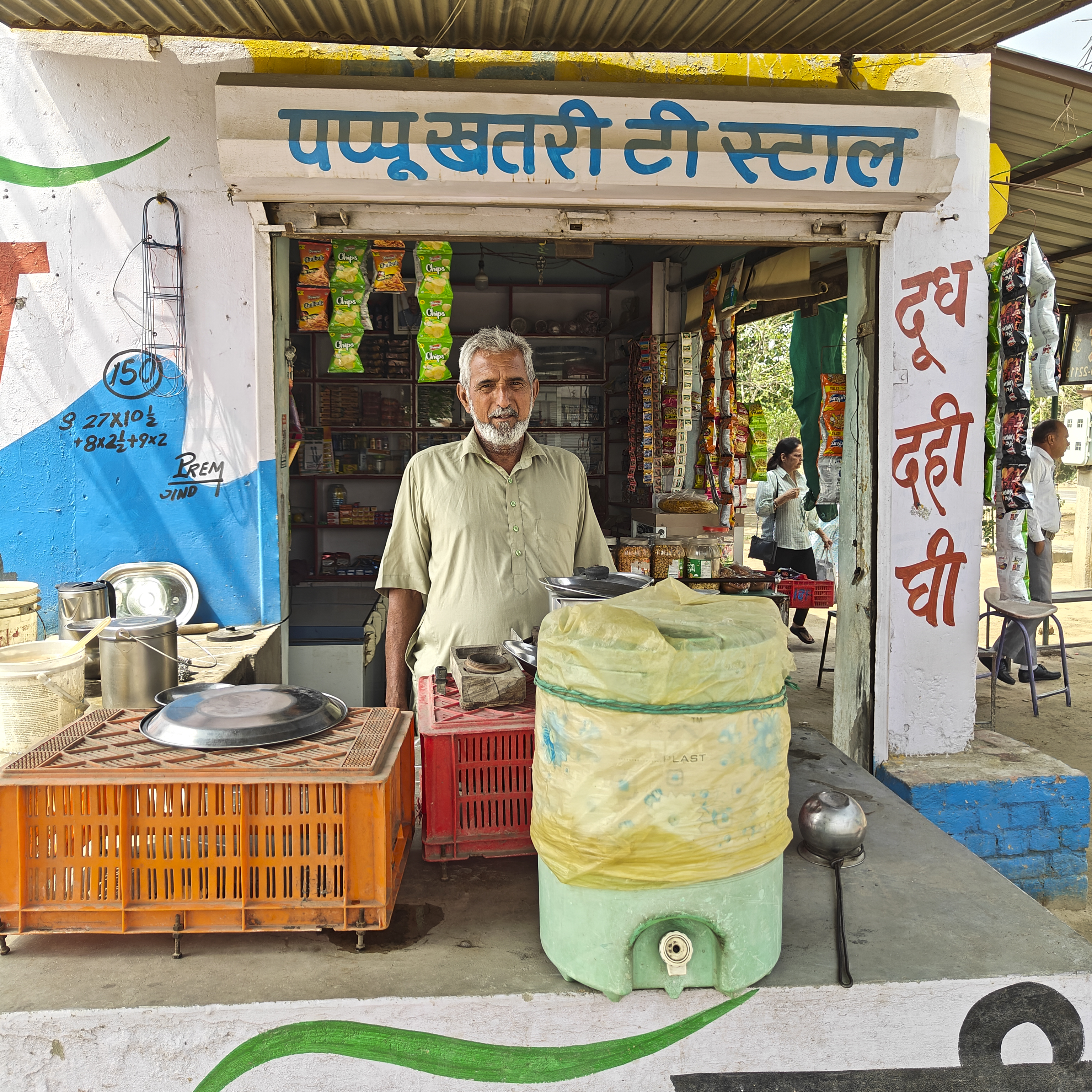
Here, Raksha’s son, Pappu Khatri, runs a rudimentary tea stall on a prime plot of land. It is a piece of history; Raksha’s husband bought these 500 yards back in 1955 for the then-princely sum of ninety rupees. Decades later, when the highway cut through their property, more than half of their house was acquired, leaving them with a meagre compensation of just 5,000 rupees. Now, the real-estate mafia eyes the remaining land – prime corner property on the highway. The mother and son are currently battling a court case built on fictitious claims designed to dislodge them. Armed only with meagre resources but boundless resilience, this feisty duo refuses to back down.
Leaving Dabwali behind, the countryside opens up into amazing vistas as the excellent highway stretches toward Hanumangarh and Suratgarh. We are heading to meet my ailing aunt, but our journey will also take us deep into the past at Kalibangan. This 4,000-year-old site was once a provincial capital of the Indus Valley Civilization, perched on the left bank of the now-dried-up Ghaggar River. Today, this seasonal, monsoon-fed river has changed its course, flowing 50 km further west along a firm bund that stretches from Himachal Pradesh before finally terminating in the sands of the Thar Desert.
Once summer gives way to the monsoon and a cooler breeze flows over this rugged land I will come back and spend a day or two with these people to learn more about their lives and write a story about them. Till then, take care, Raksha ji and Pappu Khatri. The tea was precisely to my taste, delicious – for which Pappu Khatri refused to take money.
पुरानी दिल्ली — हमारे तारीखी शहर का वह हिस्सा, जिसे मैंने बचपन से “दिल्ली की रूह” के नाम से जाना है।
वो दिल्ली मेरे दिल के एक कोने में सिर्फ़ धड़कती ही नहीं, बल्कि हर बीतते दिन के साथ अपना एक नया चेहरा भी उजागर करती है। इसकी गलियों में हमारा आज भी बसता है और हमारा कल भी। इसकी हवाओं में बेशुमार किस्से तैरते हैं, और इसके हर मोड़ पर एक नई कहानी आपका इंतज़ार करती मिलती है।
बरसों की पढ़ाई, तलाश, यादों और मोहब्बत का नतीजा यह नई किताब है, जिसके ज़रिए मैं पुरानी दिल्ली — या यूँ कहिए शाहजहानाबाद — की खुशबू, उसके लोगों, उसके बाज़ारों, उसकी तहज़ीब और उसकी अनगिनत कहानियाँ आप सबके साथ साझा करना चाहता हूँ। उम्मीद है कि यह सफ़र आपको भी उतना ही अपना लगेगा, जितना मुझे रहा है।
जल्द ही… वाम प्रकाशन से आ रहा है, पढ़ कर हौसला बढ़ाइए - आने तक तस्वीर देखिए और कापी बुक करने के लिए लिंक नीचे दिया है
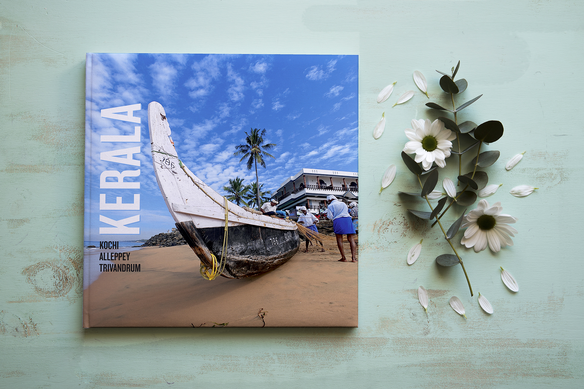
June 3: Monsoon arrives in Kerala in two days – so does our book: Kerala: A Visual Narrative of a scenic Coastal Voyage. A soulful journey by two die-hard romantics. An intimate and off-beat drive along the Arabian sea shores of Kochi, Alleppey, Kollam, and Trivandrum. The beautiful perennial Shasta Daisy flowers (next to the book), though not native to some areas in Kerala were our special welcoming companions. A travel memoir by Rajni and Rajinder Arora.
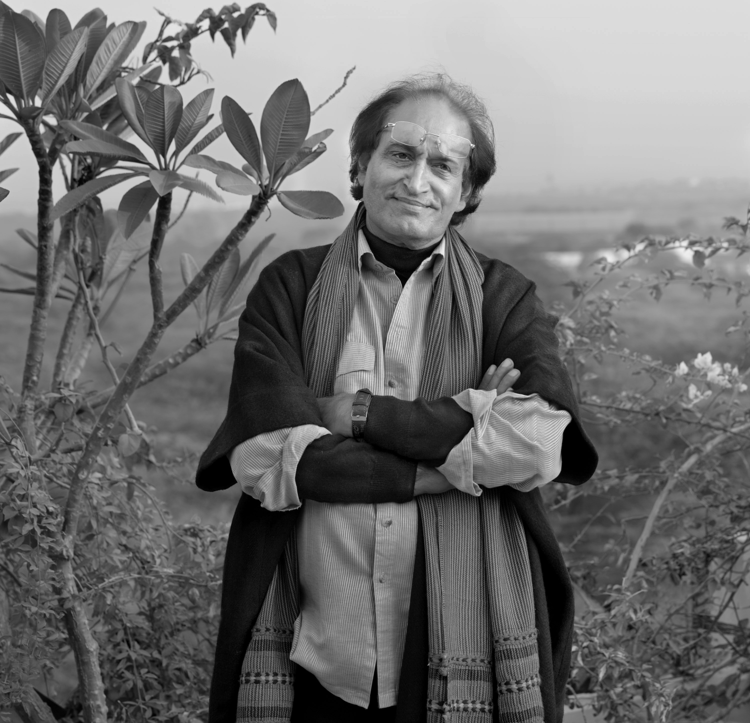
In the last 24 hours I have seen more portraits and pictures of Raghu Rai (on digital platforms) than I had ever imagined they even existed. It is sad that Raghu Rai is no more. He had been suffering for a few months. It is nice to see friends and acquaintances pouring out their love for him, and in turn, projecting their proximity to Raghu Rai. It is a veritable RR show online, an exhibition of his pictures some of which he wouldn’t even have known people cherished so much – friends, peers, fan, and acquaintances.
While a photographer is in the process of making a picture or when he is busy composing them, he doesn’t realise that he too becomes a subject of curiosity, an image himself. People knew him, people loved him as an icon, a star photographer and people adored him wherever he went. He would talk, he would explain politely and share the nuances of an art of which he was undoubtedly a master. Amateurs and youngsters in photography community addressed him as Guru and Ustaad and wanted to record their meeting with him. Undoubtedly his was a photogenic face too, handsome and his smile too could launch a few ships.
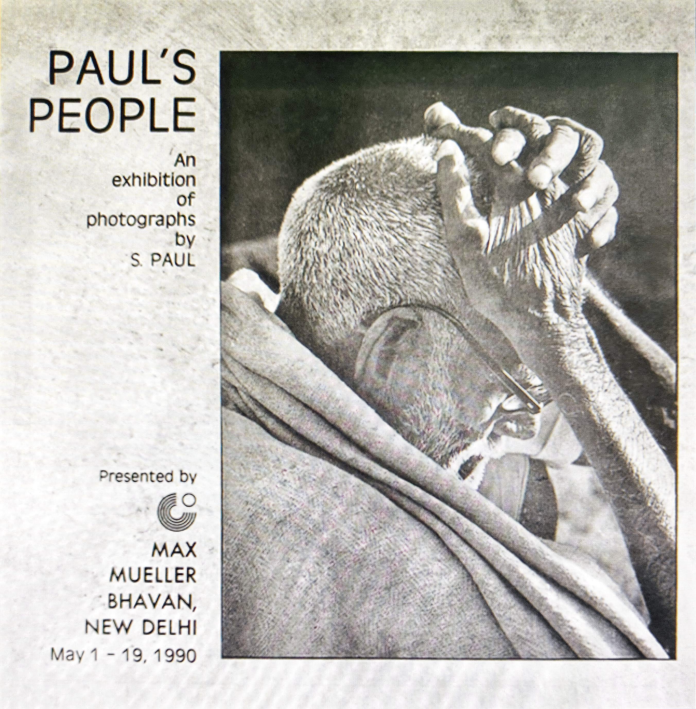
I can’t claim that he was my friend, yet our association and connection was such that we did treat each other as a friend. The first time I met him was in 1989 at his house in Rabindra Nagar next to Khan Market, Delhi. A UK based client of ours insisted on using one of Raghu’s Taj Mahal picture on the cover of his travel catalogue. Those were the days when film was used in cameras, pre-digital days. I had to pickup a 35mm colour slide from him and hand over a big amount for ‘one’ picture. He was a celebrity then and he is a celebrity now, thirty-seven years later. Even before I met Raghu Rai or had any association with him I had known his older brother S. Paul for whom we had designed and published a catalogue of his pictures. A show of S Paul’s pictures was organised by Max Mueller Bhavan, Delhi. I must say his pictures were very impressive.
As an advertising agency we are dealing with big names in photography all the time, whether for arranged shoots (industrial, architectural, food, fashion, product) or to buy stock pictures. That one meeting brought us closer and we kept meeting at art shows, galleries, social dos or at events organised by Kodak or Fuji. Ever since our meeting at SAHMAT events we got even closer.
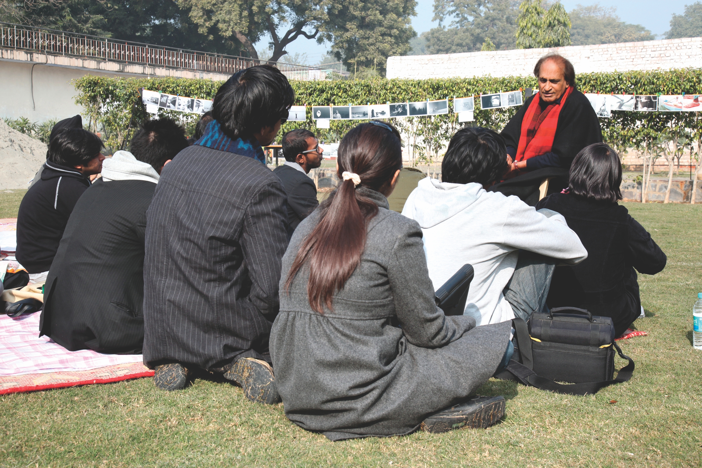
For some strange, and unknown reason I addressed him Prabhu (lord of photography??) and he would shoot back ‘Lal Pari’. About this moniker he once explained, “I have seen you many times wearing different red kurtas. Long back I saw you with your long hair bouncing off the shoulders, thus the name.” I nodded; you couldn’t argue with Raghu. I attended one of his photography workshops which he conducted open-air at the gorgeous location of Ojas Art gallery in Mehraulli. A large manicured green lawn, anchored around a banyan tree with its entangled roots hanging from its strong branches and its large leaves reaching for the earth. A tree that itself is associated with many renowned folklores was an aptly location for the master storyteller whose ‘pictured tales’.
I had never imagined that there was even a remote chance to see so many of Raghu Rai’s pictures in one go, one day without having to move from house or visiting a gallery. A very large number of Raghu’s pictures are being shared online today; pictures that are artistically superb, iconic and are a story by themselves. These pictures are being shared because they are liked by masses and are a part of public memory. Thats a way condolences are shared.
One can’t disagree with people posting his marvellous pictures but then RR was known for his keen eye, the game he played with his subjects, the locale, the foreground and background, the light and shade and the very story that moment had. RR was known for capturing a story in his pictures – sometimes those were poetry or a song; an ongoing movement that brought forth a particular moment that he captured – the one that had both, the before and after in it. And then he hung that picture for all of us to see and feel the fierceness of a sand storm, a village rising from the dust and embracing air travel,
Just like my mother, his family also came to India from Jhang where he was born. He shared it with with me after I had visited Lahore with my parents on a trip looking for their parental houses before the Partition. Raghu was eight years younger to my mother and they had shared the same mohalla. His keen eyes must have observed the ever changing subcontinent and the trauma of the uprooted families. He mentioned that he had been to Lahore long-long back in 1978 to locate their house and that for him too it was hugely emotional moment. Yet, he made full use of the opportunity and mingled with the crowd as he went about taking hundreds of pictures of the people and localities. There is very touching picture of him riding a donkey on a street, crowded with people surrounding him while he enjoyed all the attention – which all Indians get across the border.
His pictures were defining visual voices of modern India. Impressed by an exhibit of his work in Paris in 1971, Henri Cartier-Bresson, possibly the world’s greatest photographer in his day, nominated Raghu Rai to join Magnum Photos in 1977.
Today, photographers across the country are grieving a loss, but are also celebrating the life of a giant that rose above others to make his images immortal or outlive time.
Raghu Rai was not only a photographer with a keen observant eye but an artist who brought forth the aesthetics of a moment in his pictures. One can find RR pictures of almost all important events of the country from the 1970s onward. In mid-seventies, he was at the Maharishi Mahesh Yogi Ashram in Rishikesh photographing the phenomena in pop-music called the “Beatles”. His eyes found art where his contemporaries only found news. Like someone said, “Raghu’s evolution was meteoric. He raised news pics into world art. This was independent of his exceptional eye on the Taj Mahal, Mother Teresa, Dalai Lama, all the contemporary musicians. No war photographer had mixed valour, victory with a deep sense of tragedy as in his coverage of the Bangladesh war.” For those of us who shared a space in social and cultural activism, Raghu would be found standing with all for any cause. His haunting picture of a half-buried child after the Bhopal Gas Tragedy or the labour movement or even the plight of the migrants during Covid are silent sentinels of our times.
He was there, almost everywhere. Raghu Rai was in Ayodhya at the pivotal moment in Indian history when the Babri masjid was demolished. Not just that he documented the tragedy for posterity, he was at the receiving end from the Kar Sevaks who assaulted him and other photographers and his camera equipment was also damaged.
Not that I ever went with him on a photo-sortie, but I know by his sheer demeanour in all else that he did—that Raghu was never in a rush. He almost mathematically calculated every aspect of composing a shot and taking a picture I saw him taking pictures of the display of his own show in such thoughtful ways that one wonders what formule or theorems went on in his mind while making a frame.
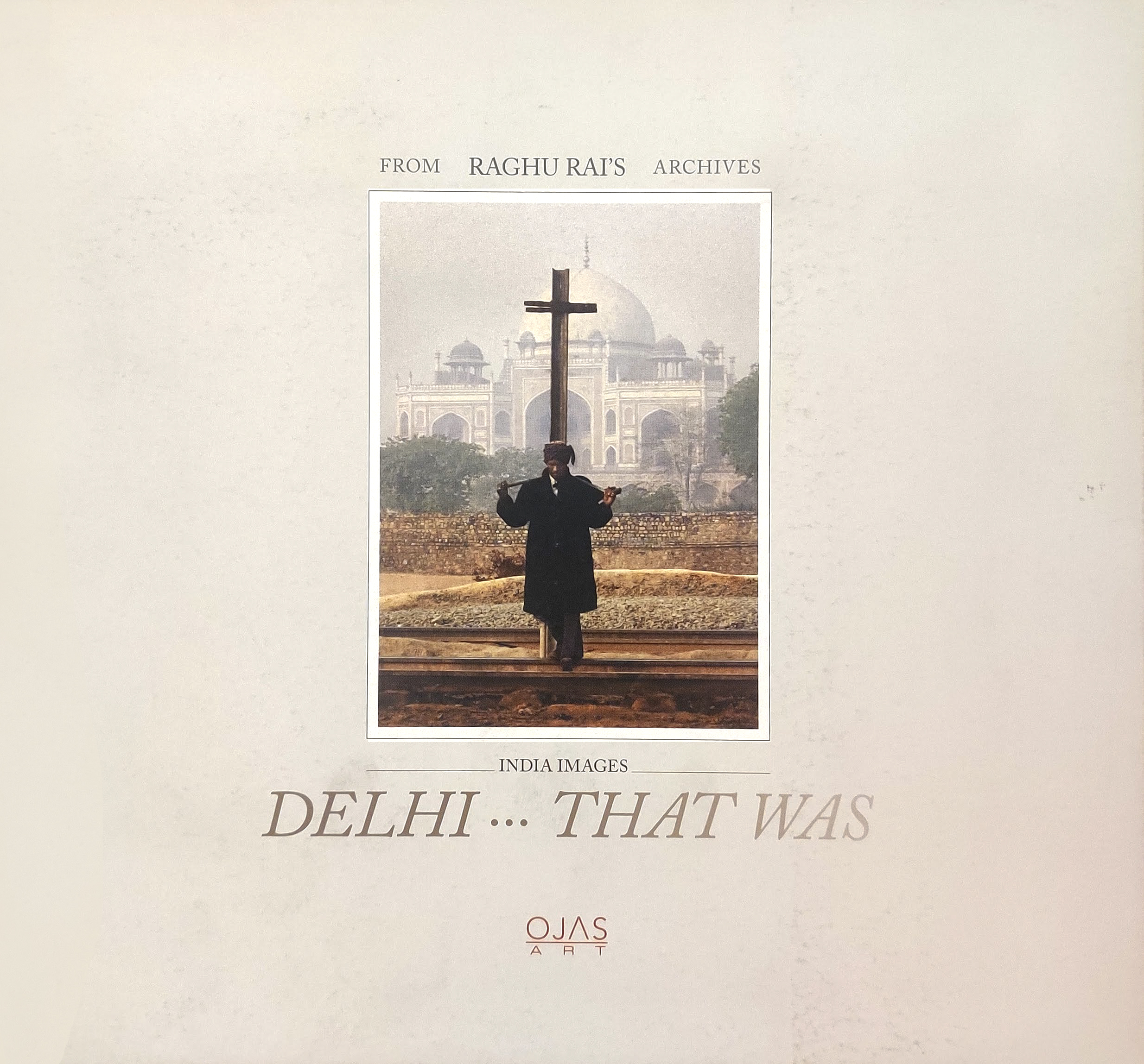
As a design agency we had the privilege of designing and printing catalogues of Raghu Rai’s shows that were assigned to us by art galleries. These catalogues gave me a chance to interact with RR on personal level for many reasons – be it technical or simply emotional. The last catalogue I did for him was for a show that exhibited photographs of three senior photographers of Delhi; namely Habib Rahman, Madan Mahata and Raghu Rai. The show was titled “Delhi… That Was”. Some of the finest pictures of these three greats were on display. On the day of the opening, Raghu went around the entire gallery interpreting each image for us who were keen to listen to him. Late Habib Rahman and Madan Mahatta would have been very happy that day listening to their pictures being deconstructed.
In Raghu Rai we have lost a visual historian, an artist, a photographer and a extraordinary human being.
P.S.: Social media platforms are a treat today to see some of Raghu Rai’s pictures that one had not seen before. It is also a rare day when we got a break from the seeing the sullen pictures of a rotten politico and his brigade.
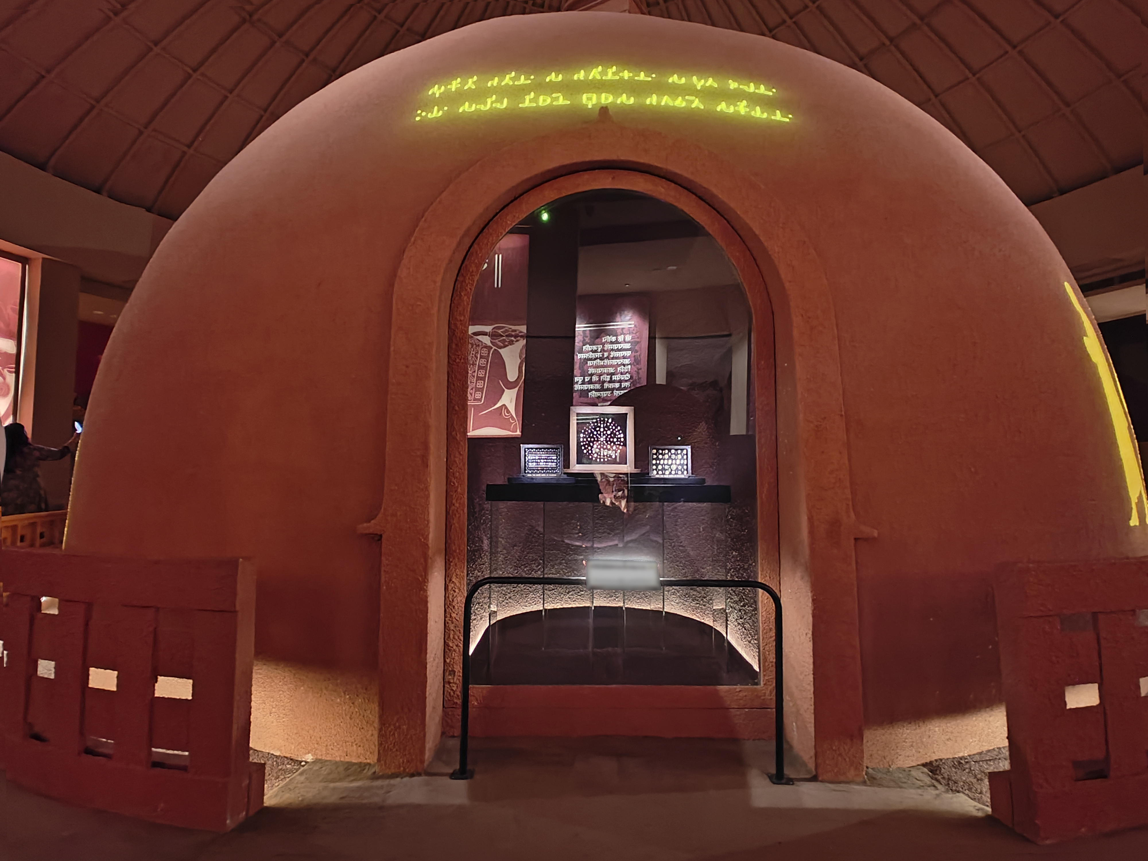
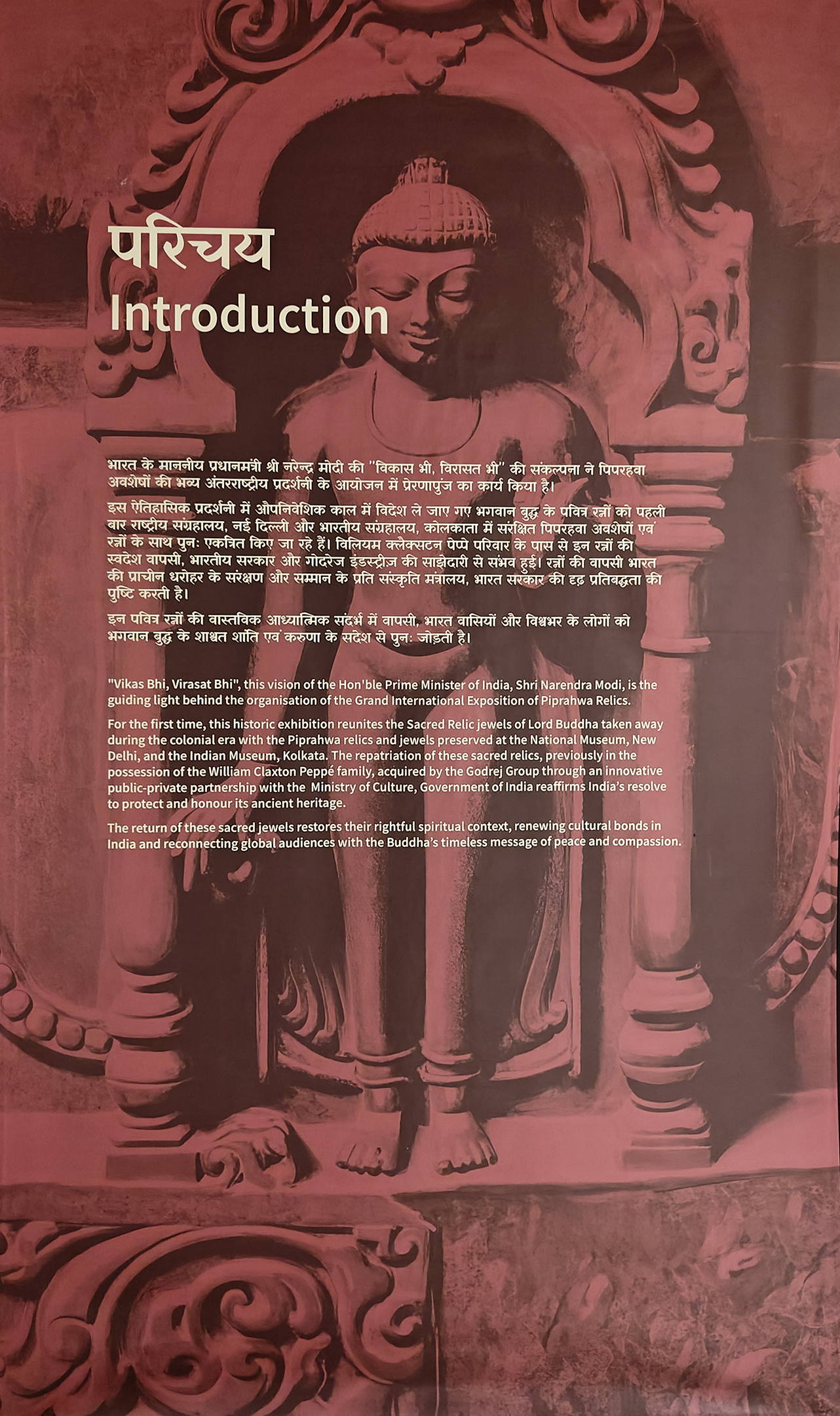
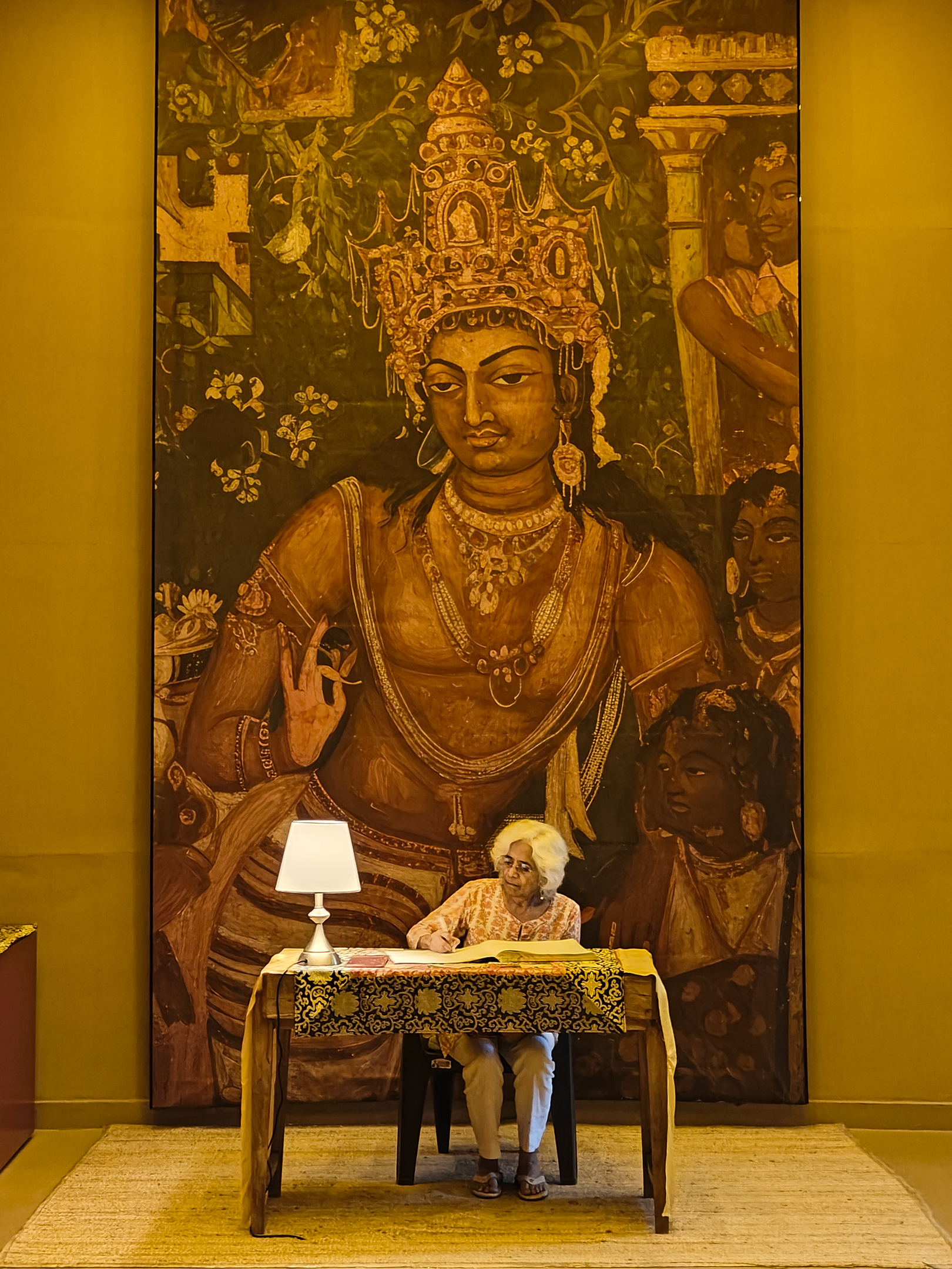
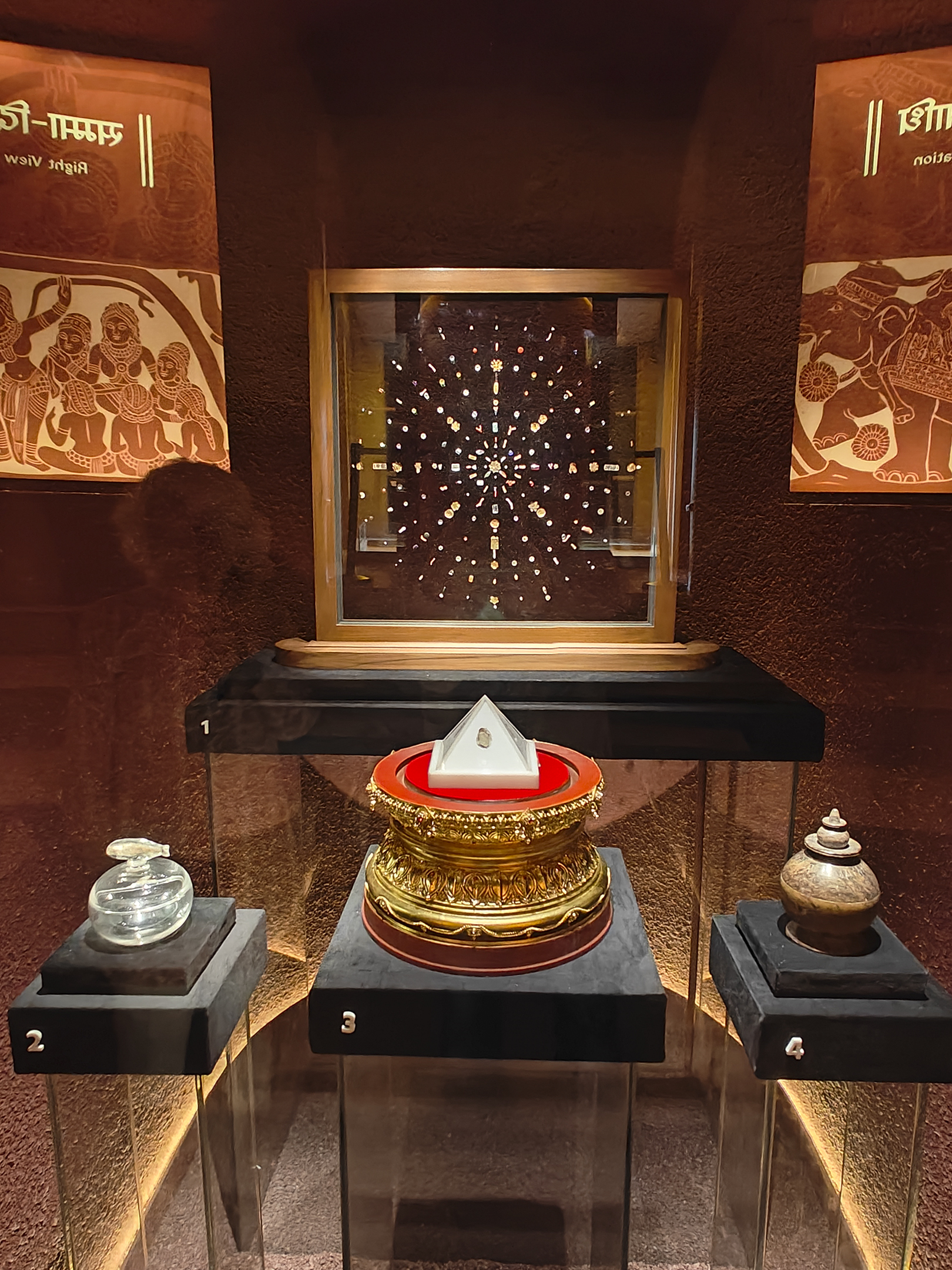
An excellent opportunity to promote the importance of the Science of Archaeology was wasted amid the din of overemphasizing faith. Bringing home the gems and relics of Buddha may indeed be a cause for celebration, yet the audio-videos were focussed only on the present master and the government of the day. In a text panel buried under heavy jargon is a line that says these relics have been ‘acquired by the Godrej Group through an innovative public-private partnership.’ Also, can the museum manager please buy a better megaphone for the guide and ask the gentleman to speak more softly? Seriously, it’s not a wedding venue!! Besides the gems and the relics – my find of the day was Elizabeth Brunner’s Walking Buddha (oil on woven mat) which transforms the Buddha-pada into dynamic steps with its soft forward march, and the Buddha painting by none other than Nandalal Bose. Do visit the show, only three weeks left of what is called as Piprahwa gems exhibition but is officially named ‘The Light of the Lotus: Relics of the Awakened One’, at the Qila Rai Pithora Fort and Cultural Complex, Lado Sarai on Press Enclave Marg, in Delhi. *Piprahwa, in Siddharthnagar, U.P. is what was known as Kapilavastu.
The official statement posted by PIB on: 02 JAN 2026 says The Ministry of Culture is hosting a landmark exposition showcasing the Piprahwa Relics, Reliquaries and Gem Relics, recently repatriated to India, at the Rai Pithora Cultural Complex. The exposition is set to be inaugurated by the Prime Minister, Shri Narendra Modi on 3rd January 2026 at 11.00 AM. This historic event marks the reunification of the Piprahwa gem relics of Lord Buddha, repatriated after 127 years, with relics, gem relics, and reliquaries from 1898 and then 1971-1975 excavations at the Piprahwa site. The exposition, titled “The Light and the Lotus: Relics of the Awakened One,” thematically showcases relevant antiquities and works of art from several cultural institutions under the Ministry of Culture. These relics represent the most extensive assemblage attributed to the Buddha, symbolizing profound philosophical meaning, masterful craftsmanship, and global spiritual significance. The exhibition features over 80 objects spanning the 6th century BCE to the present, including sculptures, manuscripts, thangkas, and ritual objects. This unprecedented gathering commemorates the Ministry of Culture’s successful repatriation of the relics in July 2025, achieved through a public-private partnership, halting an auction at Sotheby’s Hong Kong. For the first time since the 1898 excavation, the exposition brings together:
Relics from the 1898 Kapilavastu excavation
Treasures from the 1972 excavations
Reliquaries and jewelled treasures from the Indian Museum, Kolkata
Recently repatriated relics from the Peppé family collection
Monolithic Stone Coffer within which the gem relics and reliquaries were originally found.
The sacred Buddha relics were discovered in 1898 by William Claxton Peppé at the ancient stupa of Kapilavastu. Following their discovery, portions were distributed globally, with one part gifted to the King of Siam, another taken to England, and a third preserved at the Indian Museum, Kolkata. In 2025, the Peppé family portion was repatriated through decisive intervention by the Ministry of Culture, supported by Buddhist communities worldwide. The exposition underscores India’s role as the birthplace of Buddhism and reinforces its position as a global spiritual and cultural leader. Under the leadership of Prime Minister Narendra Modi, India’s global engagement increasingly draws upon its civilizational and spiritual inheritance, 642 antiquities have been repatriated to India, with the return of the Piprahwa relics standing as a landmark achievement.
The inauguration will witness participation from Union Ministers, Ambassadors and members of the diplomatic corps, venerable Buddhist monks, senior government officials, scholars, heritage experts, esteemed members of the art fraternity, art aficionados, followers of Buddhism, and students.
The exposition reaffirms the Ministry’s commitment to heritage preservation and cultural leadership while celebrating India’s spiritual legacy and its significance as the birthplace of the Buddha Dhamma, reflecting India’s enduring commitment to preserving and sharing its civilizational heritage with the world.


You must be logged in to post a comment.