There is so much around us from the past, our history, culture, and traditional knowledge that there seems very little time at hand to know, see and share it all with others. So much is continuously being created that must be seen and understood.
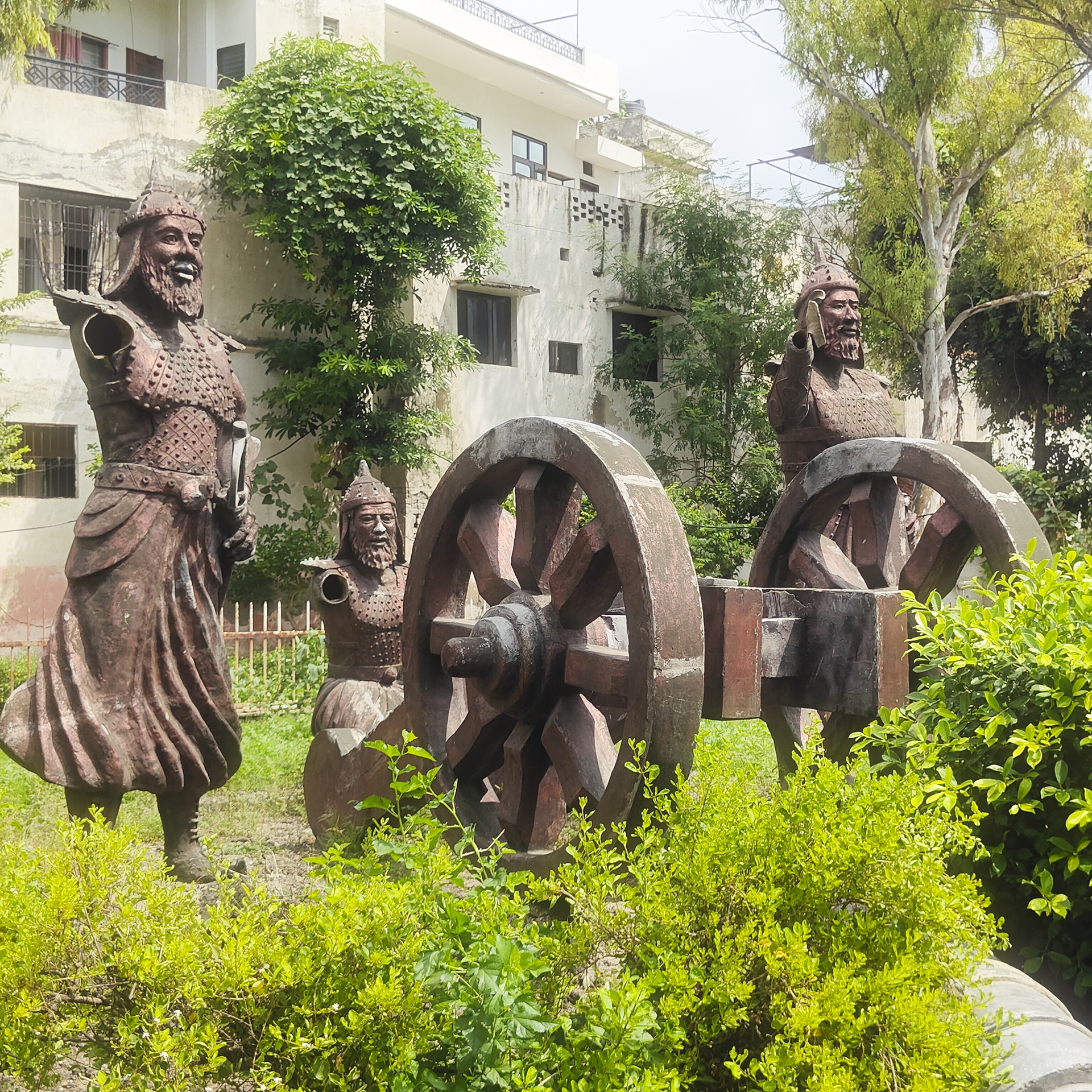
These weathered metal sculptures of medieval warriors and a large artillery carriage, supposedly celebrate Mughal victory over Sultan Lodi in the First Battle of Panipat, 1526.
In tatters, rusted and ill-maintained, today these sculptures are in a pathetic condition. The hands of two warriors are broken, while the turret of the artillery gun lies damaged on the ground; they look morose and tired. Maintained by the Municipal Corporation of Panipat (MCP, is their acronym), the park itself is unclean and in a sad condition. Considering the fact that this is the tomb of Ibrahim Lodi the last Sultan of Delhi, couldn’t it have been maintained better.
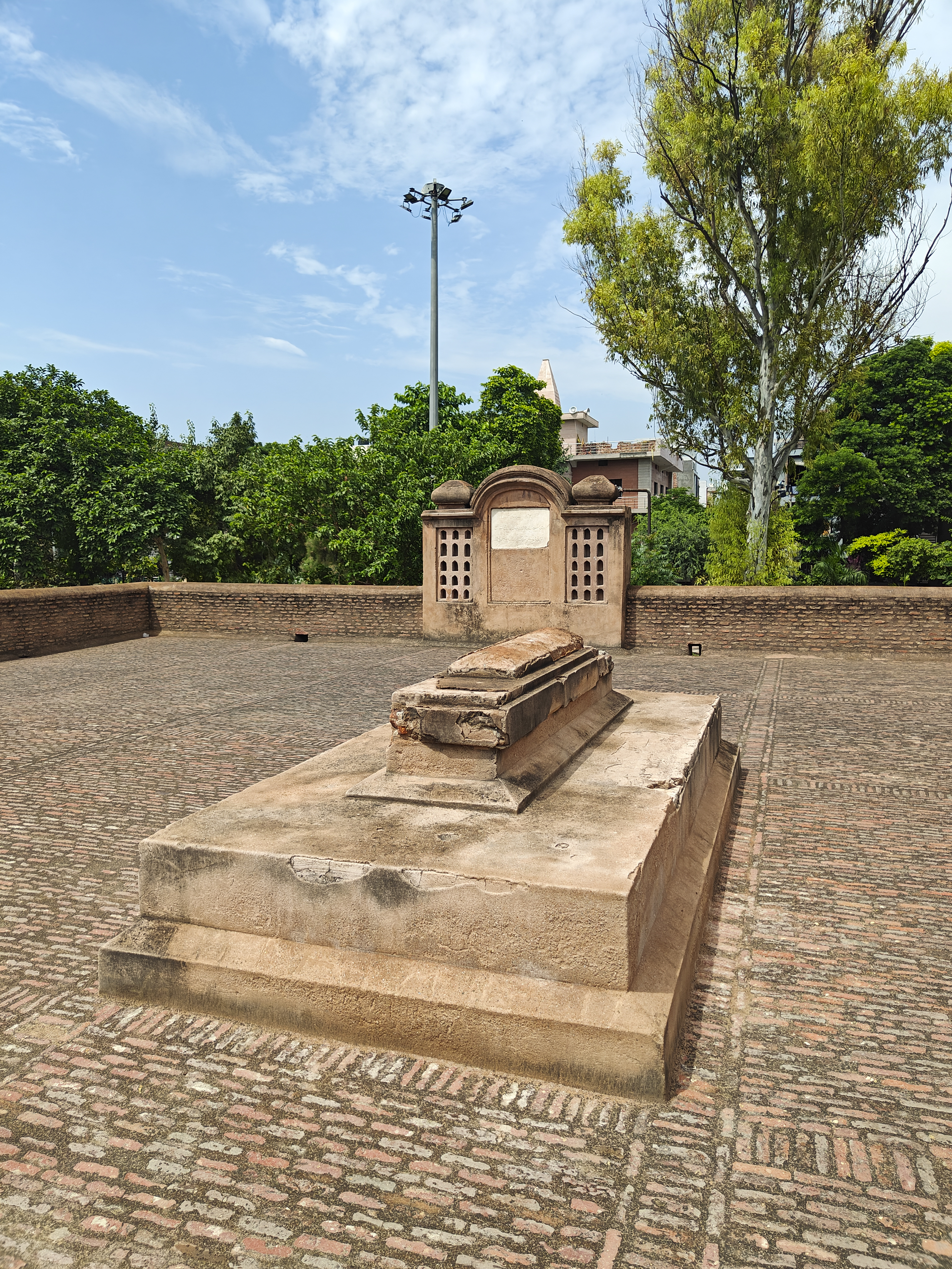
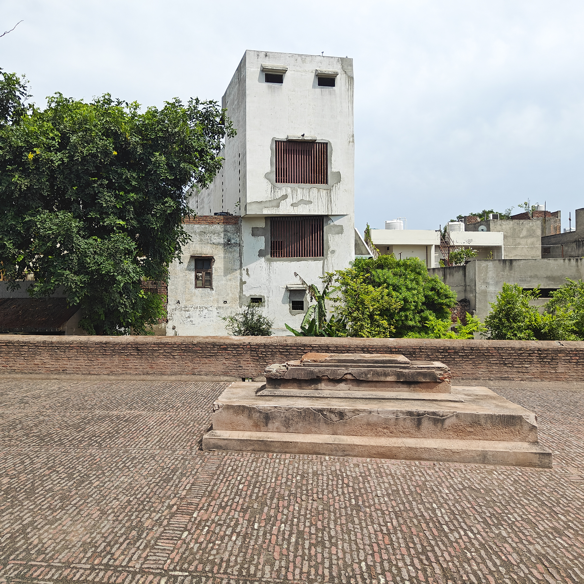
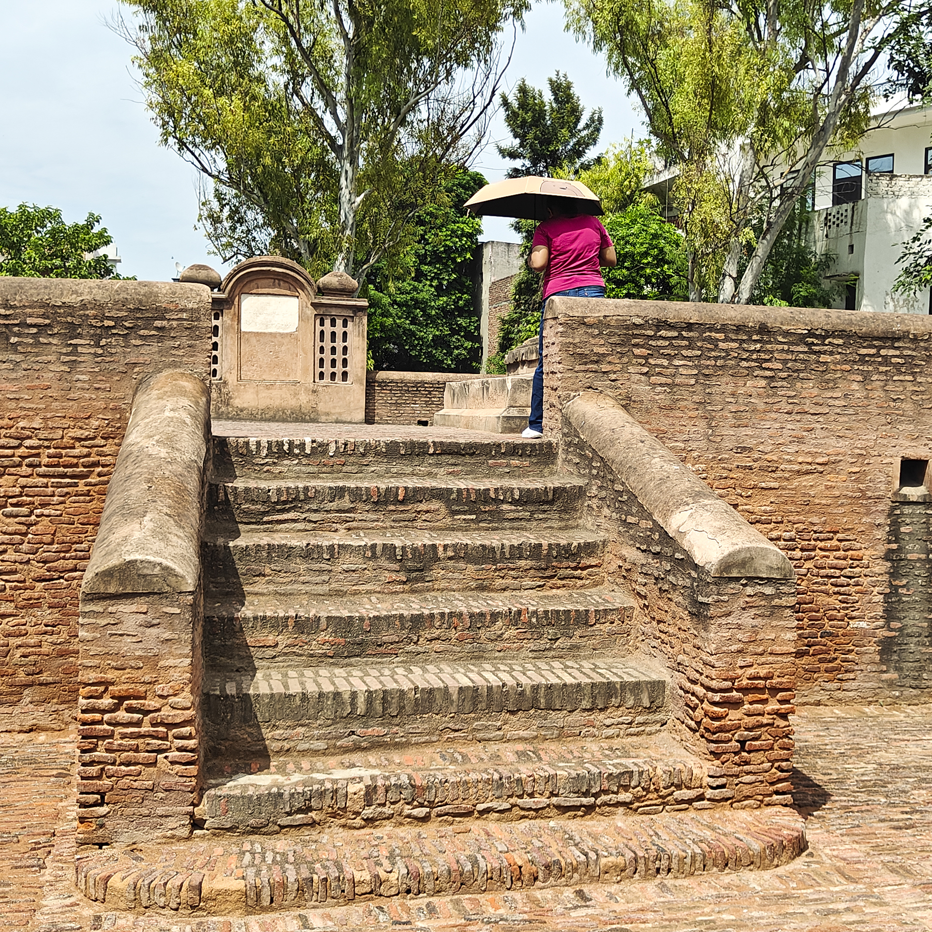
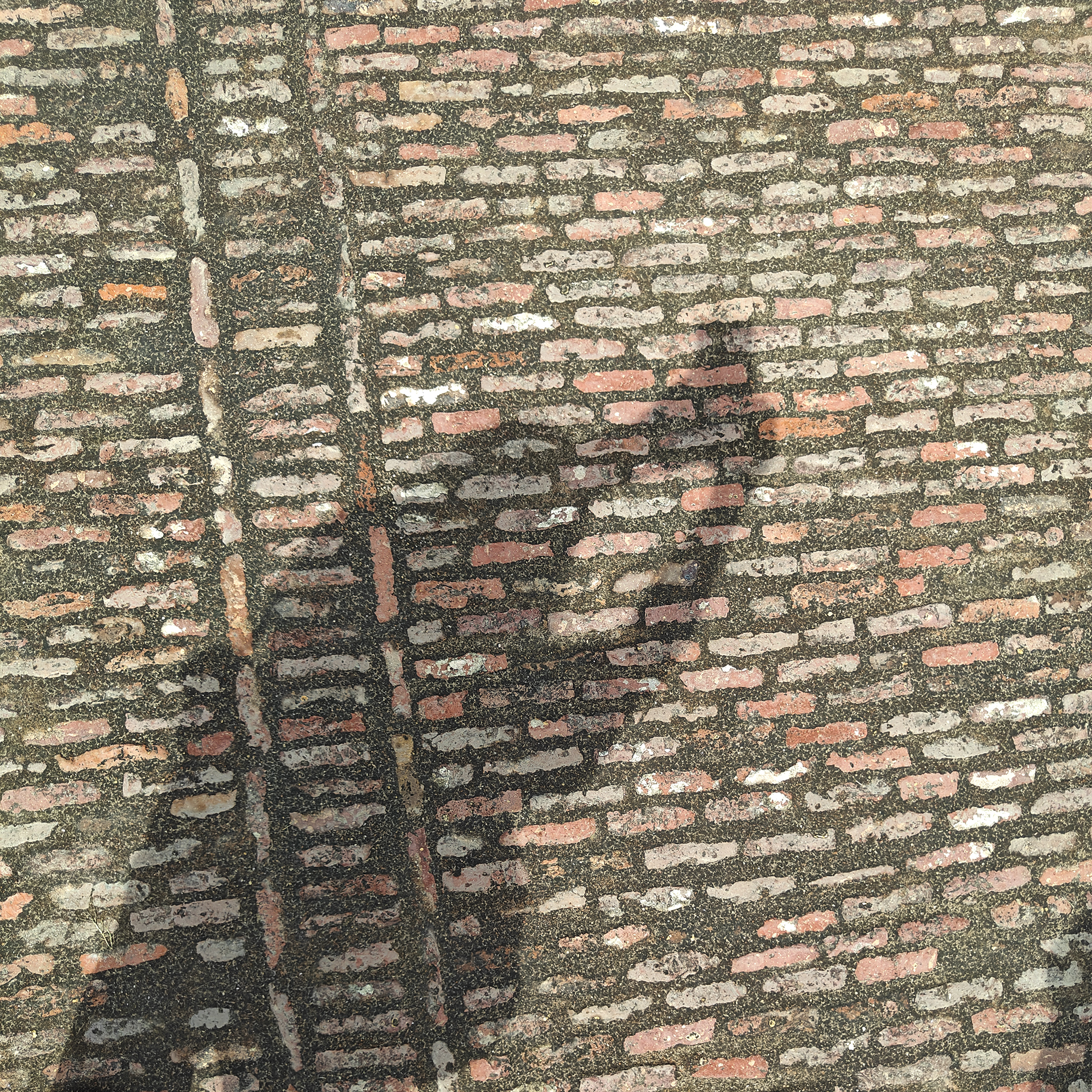
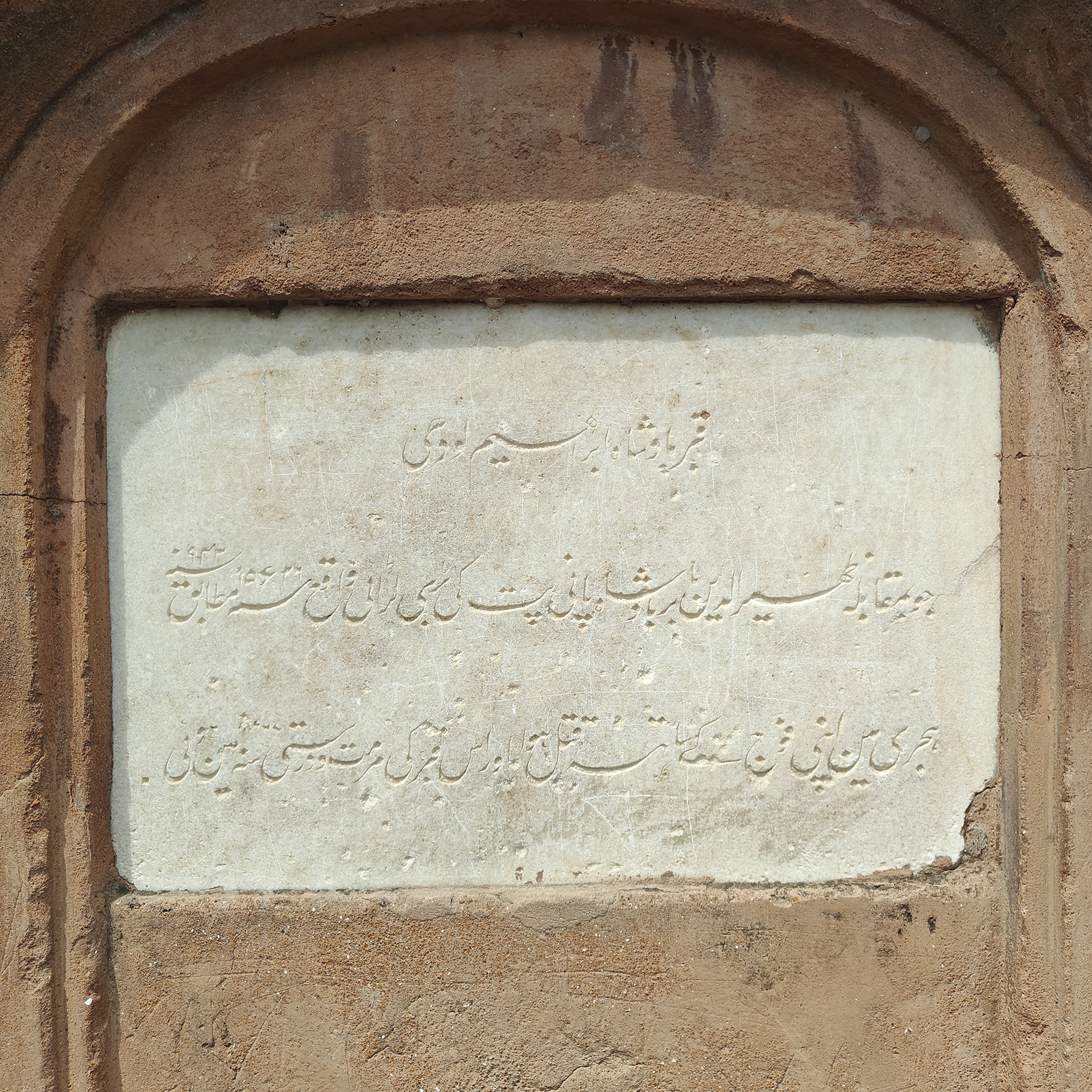
Ibrahim Lodi, the last ruler of his dynasty – a draconian king, rests here in the soil of Panipat. His open to sky tomb is on a double platform at a park in Tehsil Camp. The tomb, marked by a rectangular grave on a raised platform, was built using Lakhauri bricks. An inscription on a niche near the grave declares that it was repaired and restored by the British in 1867 AD.
There must be something special about the plains of Panipat that it saw three major battles – the First Battle of Panipat was fought on April 21, 1526, between last ruler of Delhi Sultanate Ibrahim Khan Lodi and the Mughal Zahir-ud-din Babur. Ibrahim Lodi, the was killed in this battle. Babur used his artillery to emerge as the victor.
The Second Battle of Panipat was fought on November 5, 1556, between Akbar (under Bairam Khan) and Hemu Vikramditya, the last Hindu emperor of Delhi during which an arrow struck Hemchander in the eye causing his army to retreat, following which Akbar won the battle.
The Third Battle of Panipat was fought on January 14, 1761, between the Marathas led by Sadashivrao Bhau and Ahmad Shah Abdali. The Marathas suffered a devastating defeat in this battle.
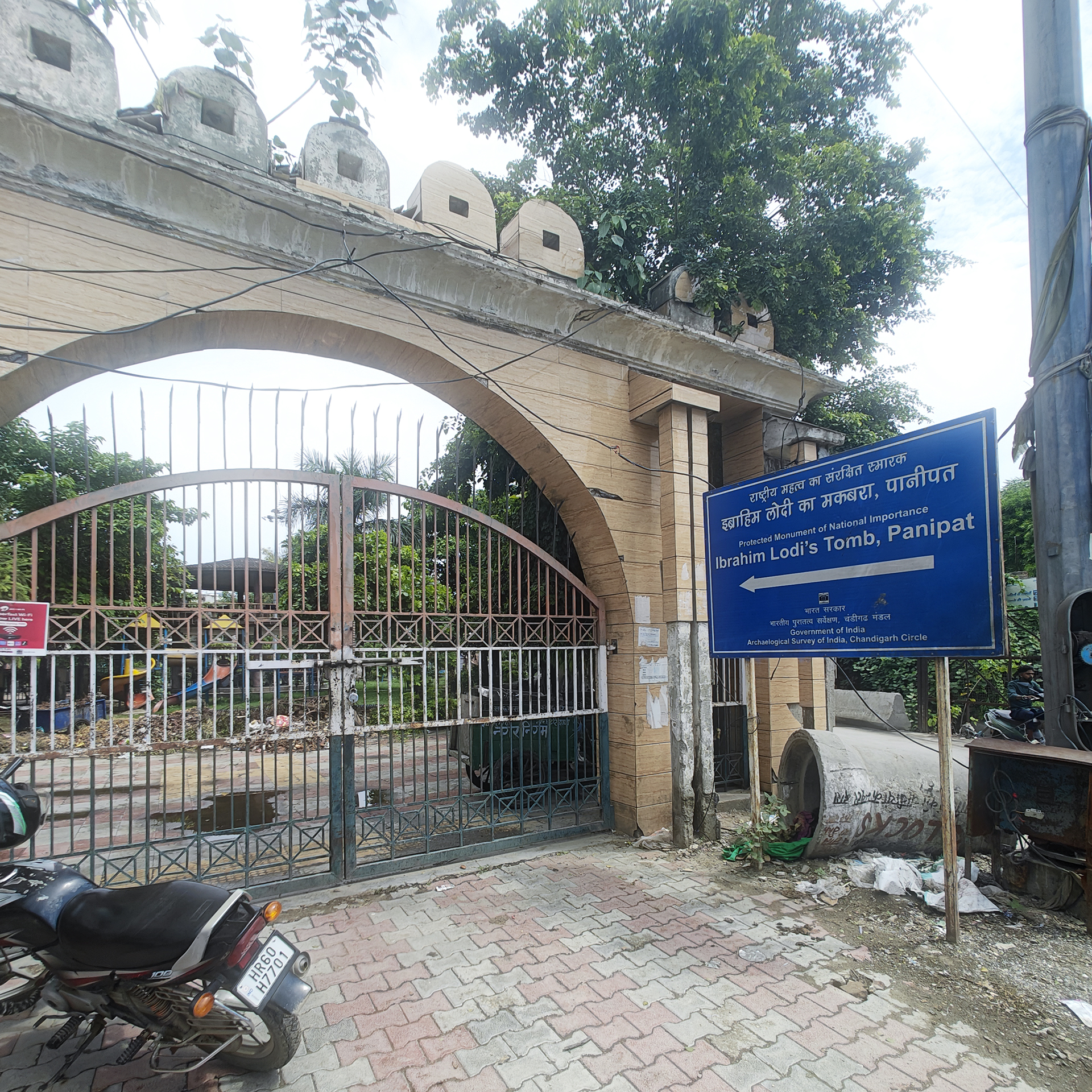
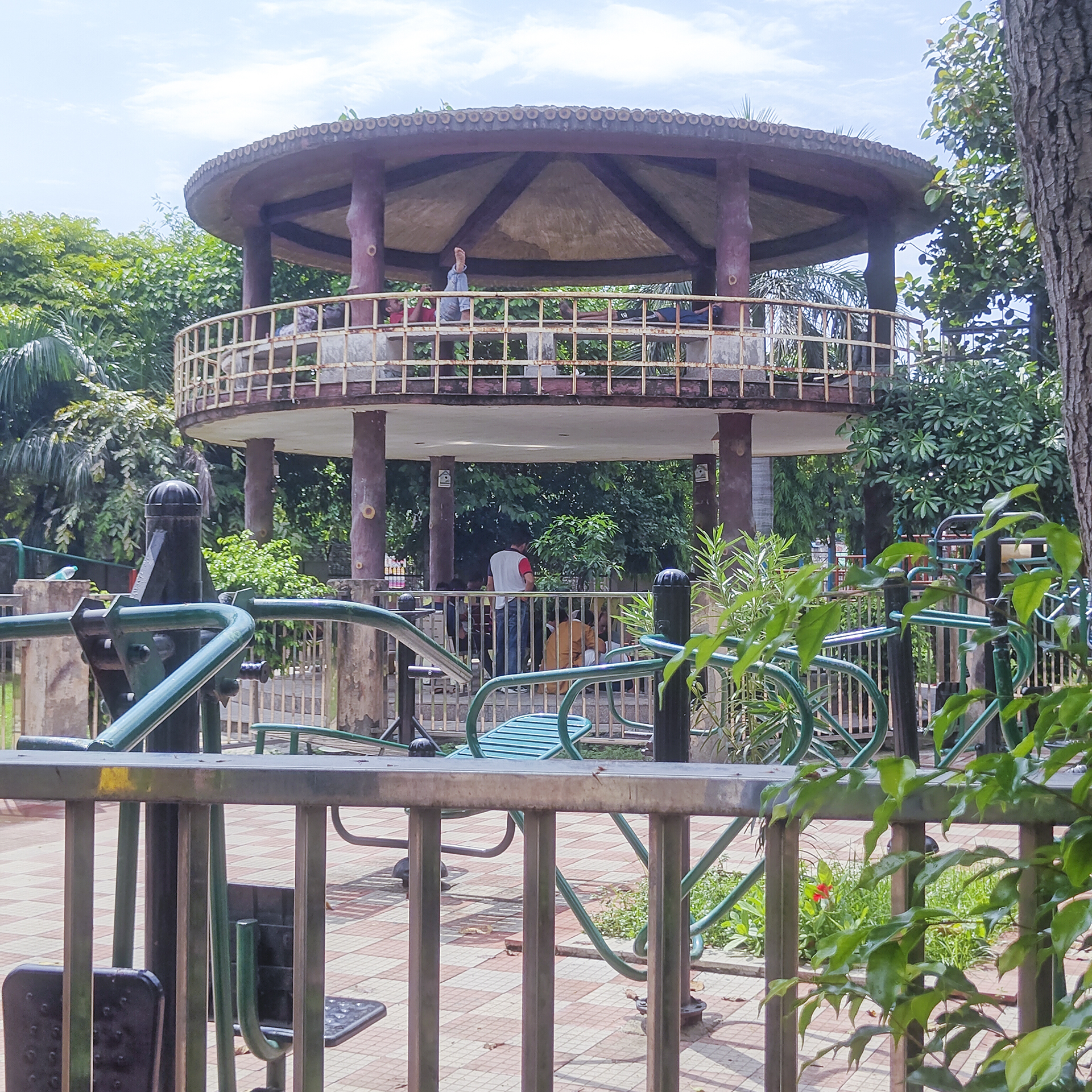
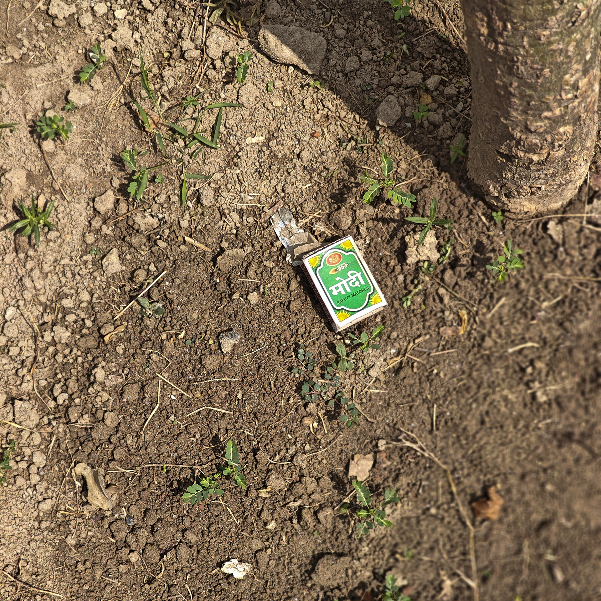
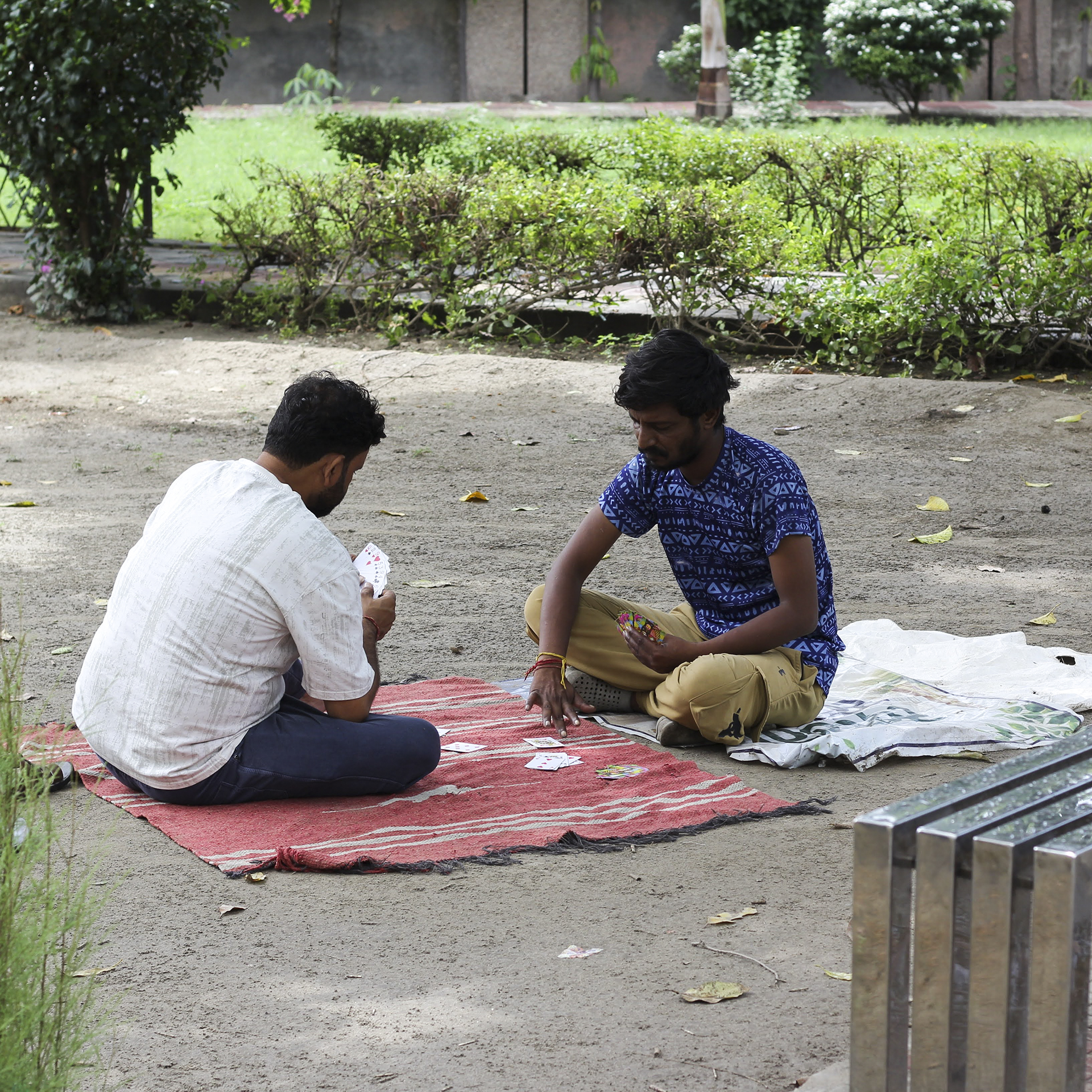
Though the sign outside the park says it is Protected Monument of National Importance, the fact remains that there was not one attendant in or around the Tomb. The main gate was locked and parked inside the gate was a garbage collecting cart beyond which was a big waste dump of leaves and other junk material. I wondered what is the purpose of the double level circular platform from which one couldn’t see more than 200 meters ahead. Groups of people were seen smoking and playing cards inside. Someone had left washed clothes to dry on the grass; food and leftovers were scattered in another corner while the entire grass patch was littered with cigarette butts, bidi stubs and empty matchboxes. A matchbox named after a leader lay there in dirt under an Ashoka plant.
From a distance it looked like any other children’s playground with plastic-ki slides and swings though partially broken and dirty. As usual it was ill-maintained, unkempt, with garbage and waste dumped around. But for the blue ASI sign you would miss the tomb easily. The main gate to the so called ‘monument’ is permanently locked which faces an open sewage drain that spreads the stink for meters ahead. In the narrow side lane cars and scooters are parked of the residential habitat touching it. The side gate to the tomb/park is designed for hurdle race practice that can only be cleared by athletic bodies – possibly keeping in mind the Lodis or the Mughals.
Sculptures of medieval warriors at Ibrahim Lodi’s tomb, PanipatIbrahim Lodi’s tomb and inscriptionThe grave and the residences facing itoplus_1048608The double platform tomb and its approachLakhauri brick floorThe inscription plaquethe circular resting areathe matchbox under Asoka plant/tree
Gharaunda sounds like a dainty toyhouse or a dollhouse-like nest, offering the safety of a mother’s hug. I wonder who named this small town in Karnal district as Gharaunda—a town desperately trying to unhinge itself from its past and join the mainstream madness of our stunted cities. Located on NH44, the town is choking not only with dense habitation and heavy traffic but also with the petroleum fumes that permeate its air.
Nearly 400 years ago, the Tughlaqs, the Lodis, and then the Mughals cleared part of the dense jungle to create a road connecting Bengal to Afghanistan and from there to Uzbekistan, Iran and beyond. Along the road they built Kos Minars, piaos, and Sarais. While some of the Kos Minars still survive, most of the sarais have scummbed to time or illegal occupation.
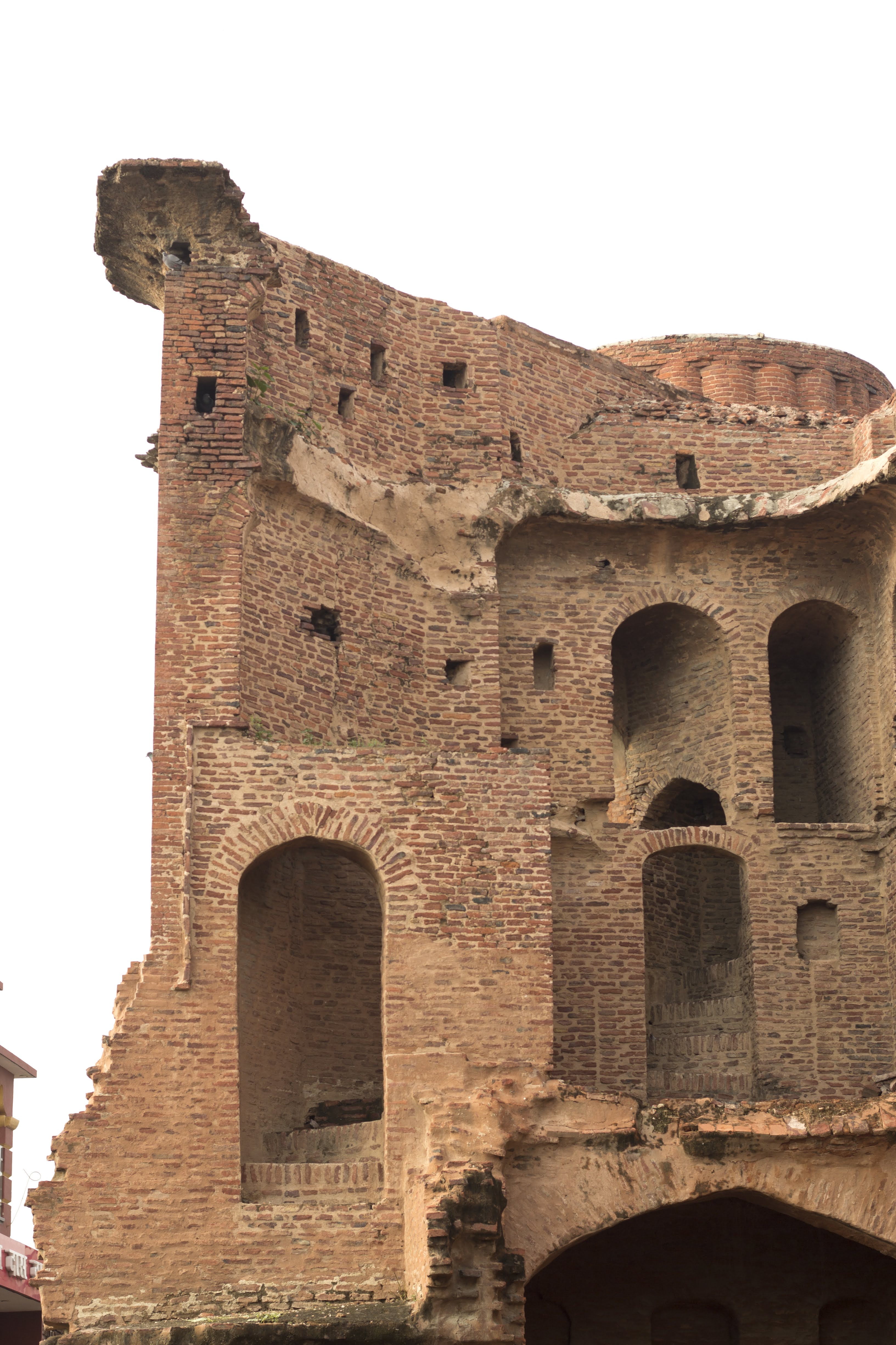
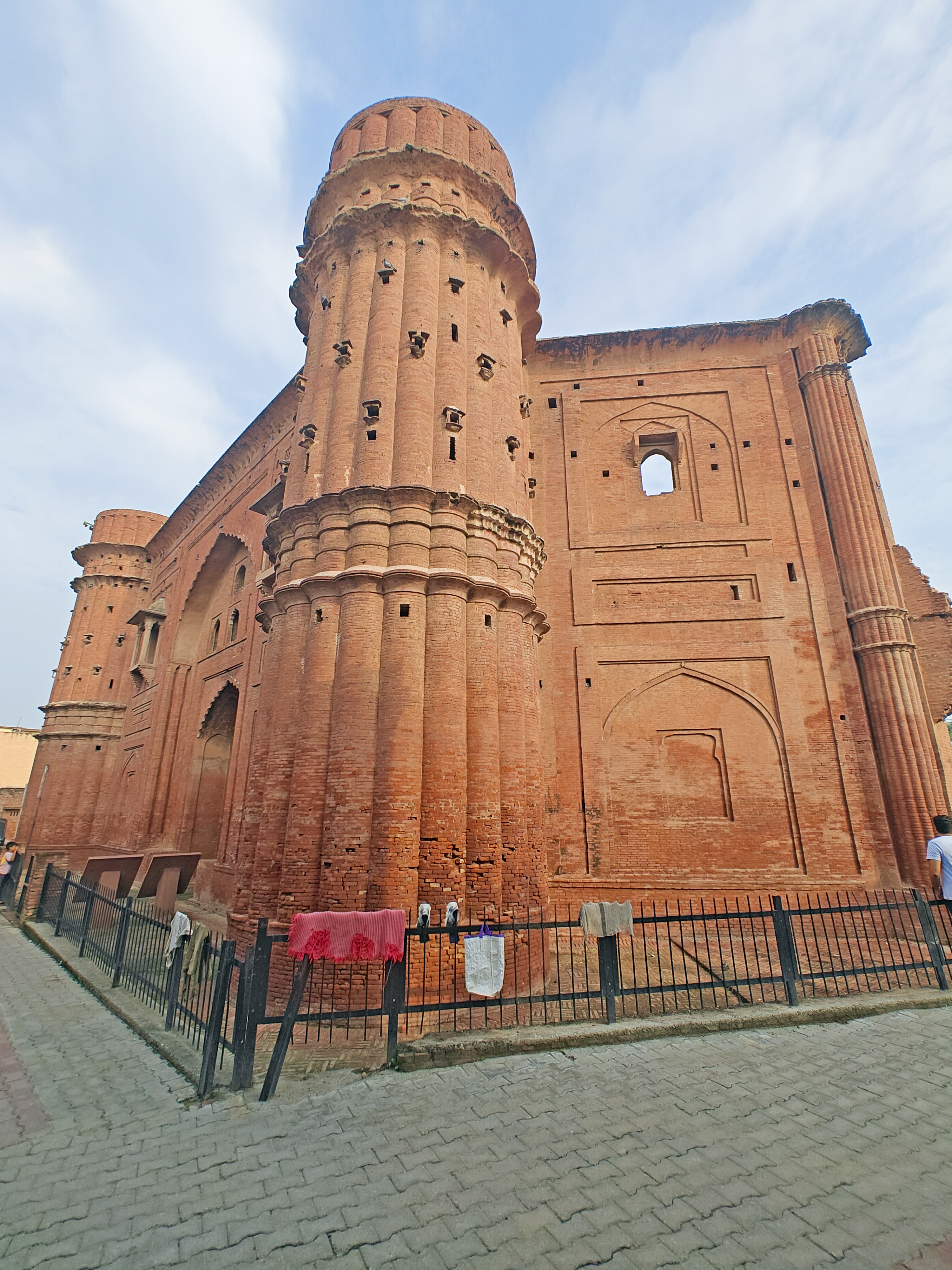
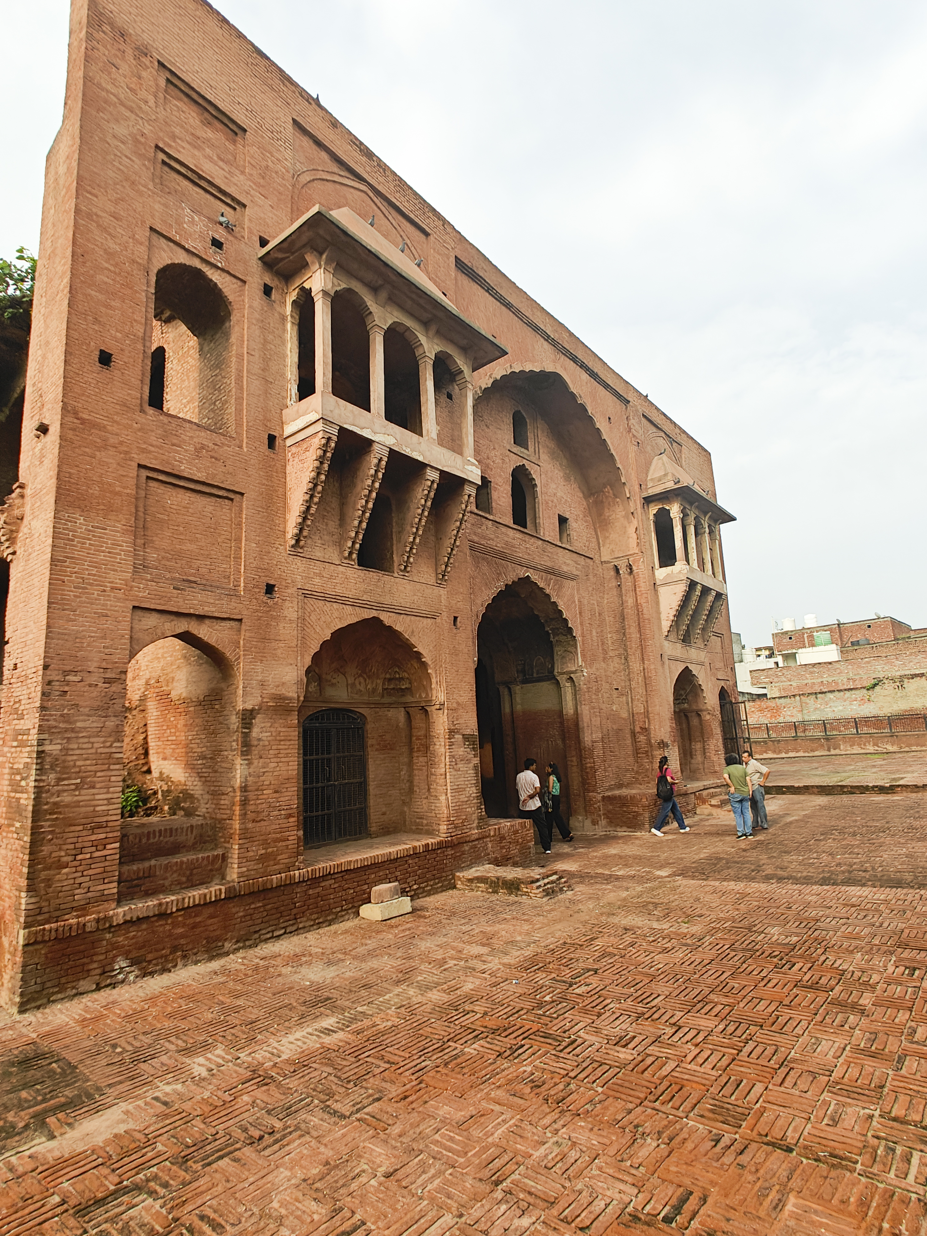
One dazzling Sarai defied all and has stood tall through the centuries – in fact it looks as fresh as the day its three stories were constructed. It is one of the finest examples of decorative brick structures that have survived the test of time and the onsualght of expanding urban areas.
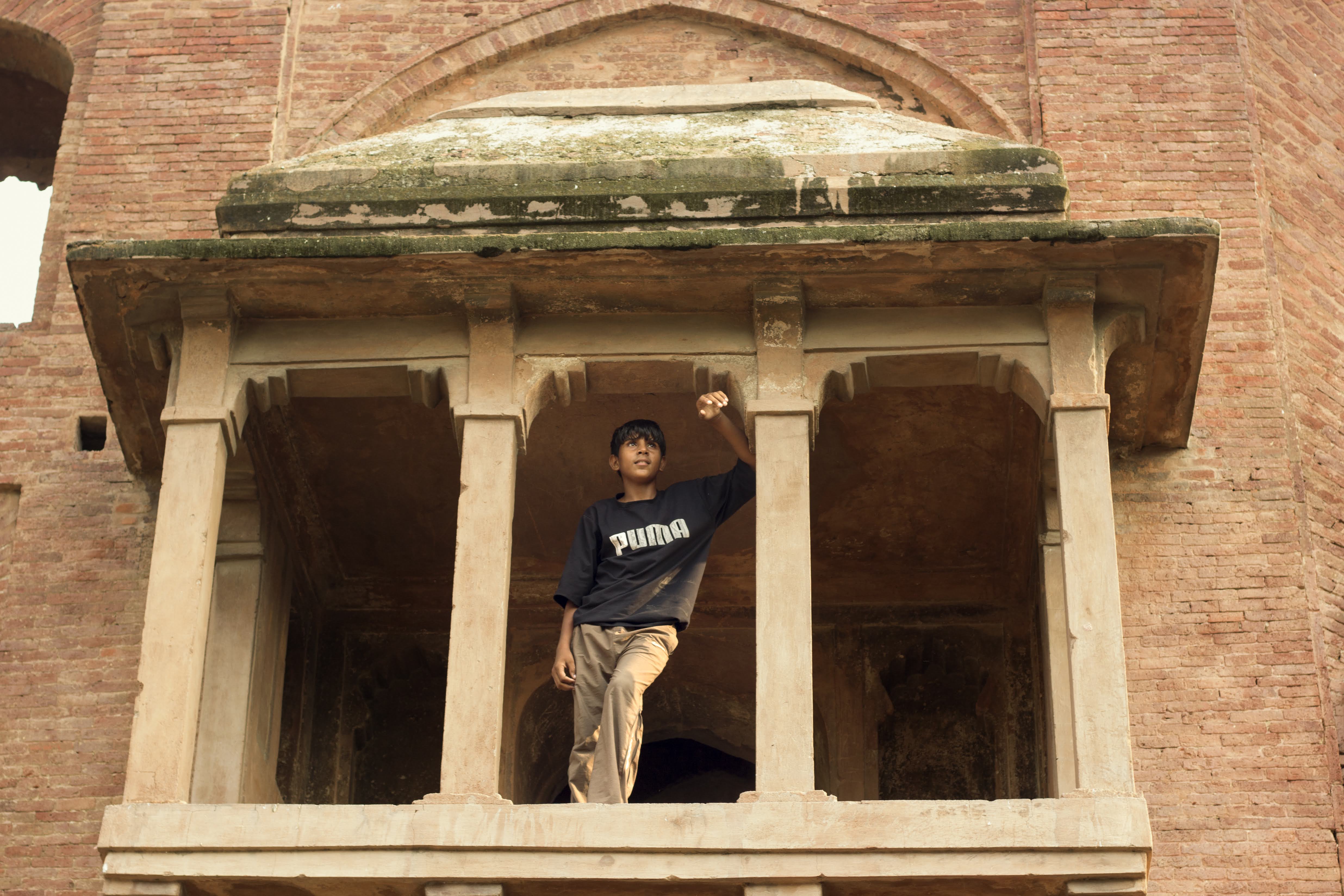
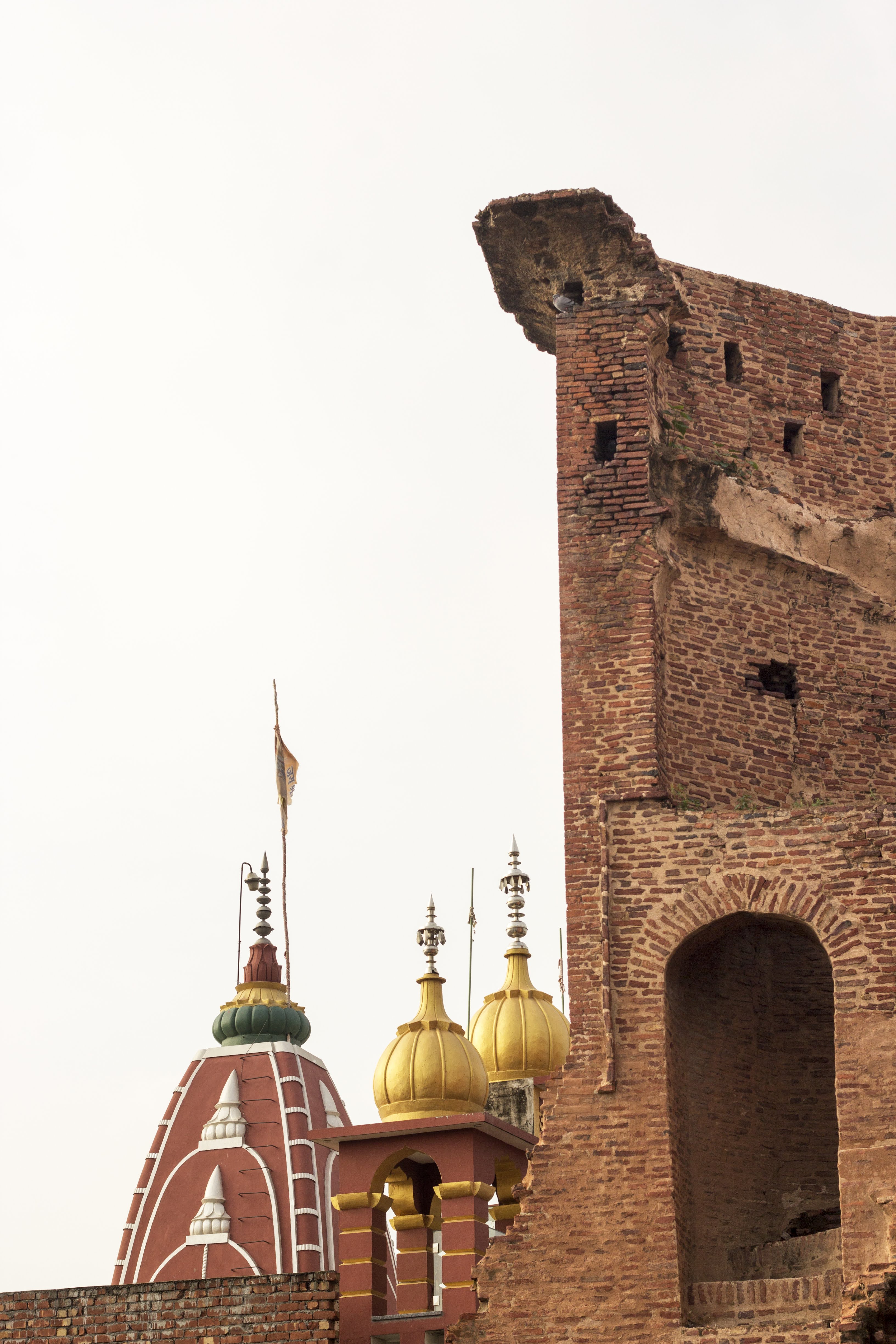
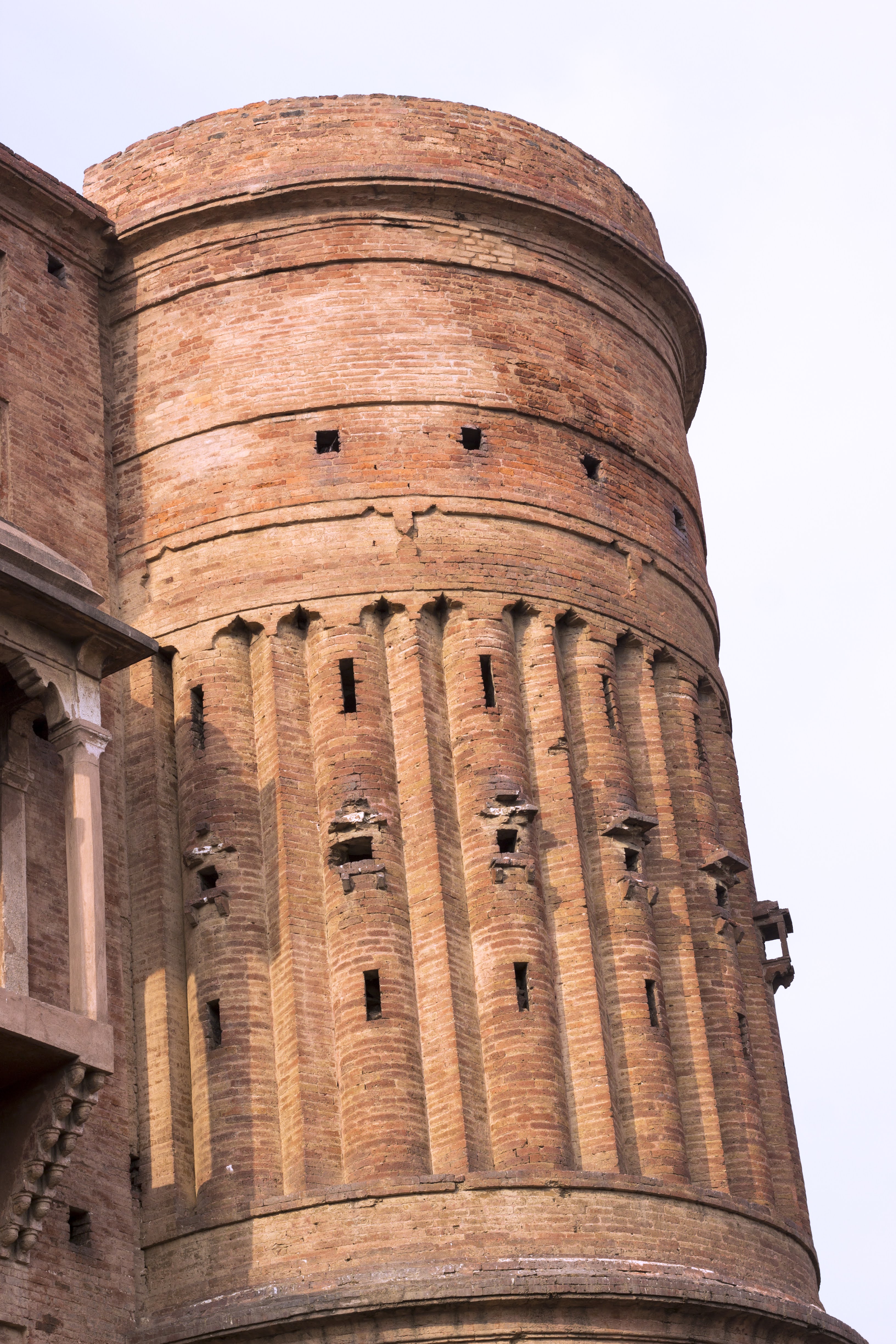
The ‘Mughal Sarai,’ as it is called, is a protected monument under the Archaeological Survey of India, though it is ill-maintained. A narrow lane leads to the vibrantly amazing structure; however, the front facade of which can’t be seen or photographed in totality because there is very little depth available. Crane your neck hard to see the tall circular turrets on each end of the gateway. The western portion of the Southern gateway, part of which has fallen apart, appears to be an Ebrahim Alkazi theatre set where a Mughal dastan is set to be played.
Built in 1637 AD by Feroz Khan during the reign of Mughal Emperor Shah Jahan, this quadrangular Sarai (rest house) naturally came to be named after the Mughals. The historic site of Gharaunda, where the Sarai stands, also served as a campsite for Babur prior to the First Battle of Panipat.
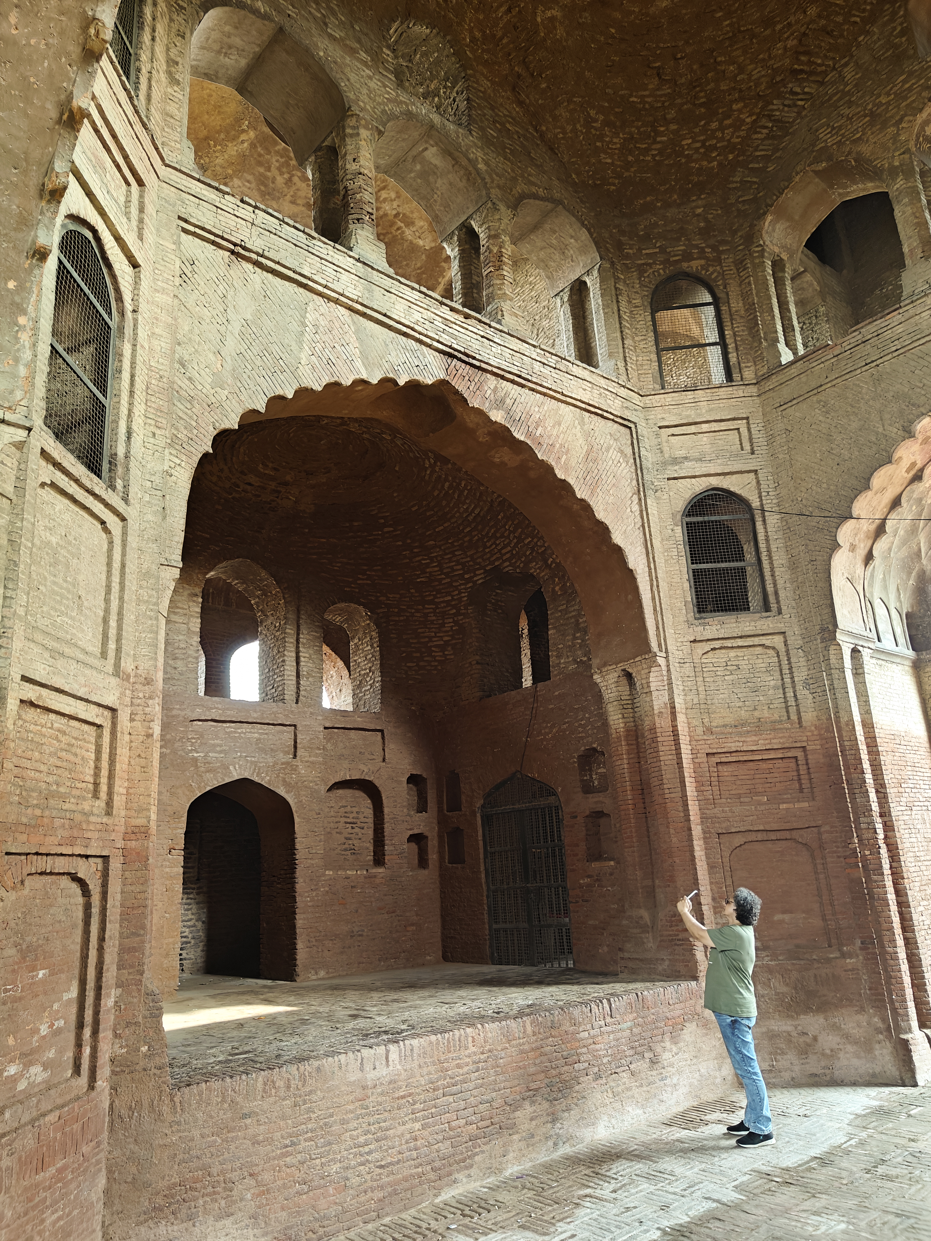
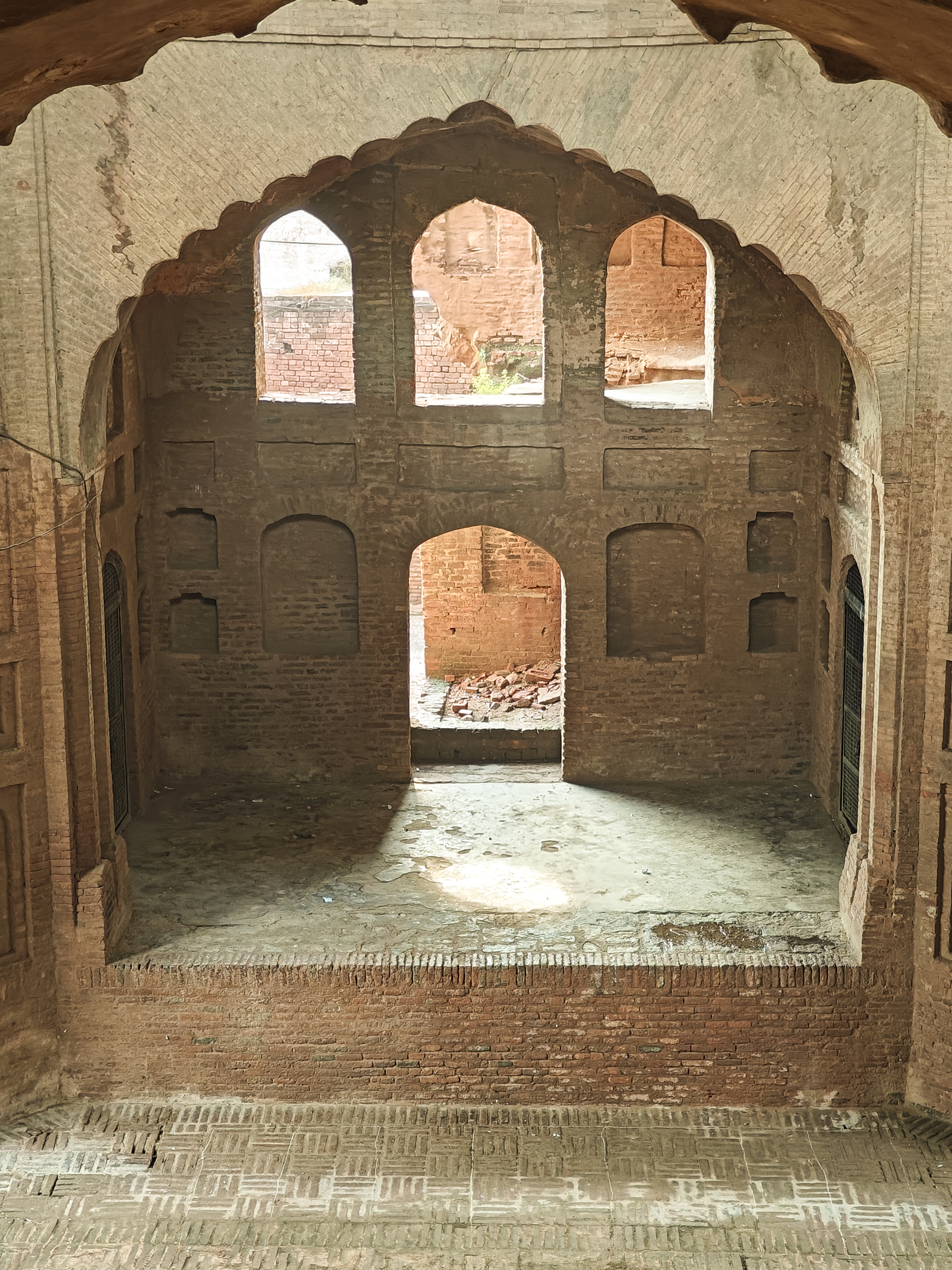
Today, two of these three-story gateways still stand within the area, positioned roughly 100 metres apart along the remains of the Northern and Southern walls. Constructed from traditional Lakhauri bricks, these structures feature an enclosed design with cells lining all four sides of the quadrangle. The surviving gateways are highly ornate, decorated with intricate panels, balconies, rounded towers, and angular flutes.
A must visit site if you are passing by Karnal or surrounding areas.
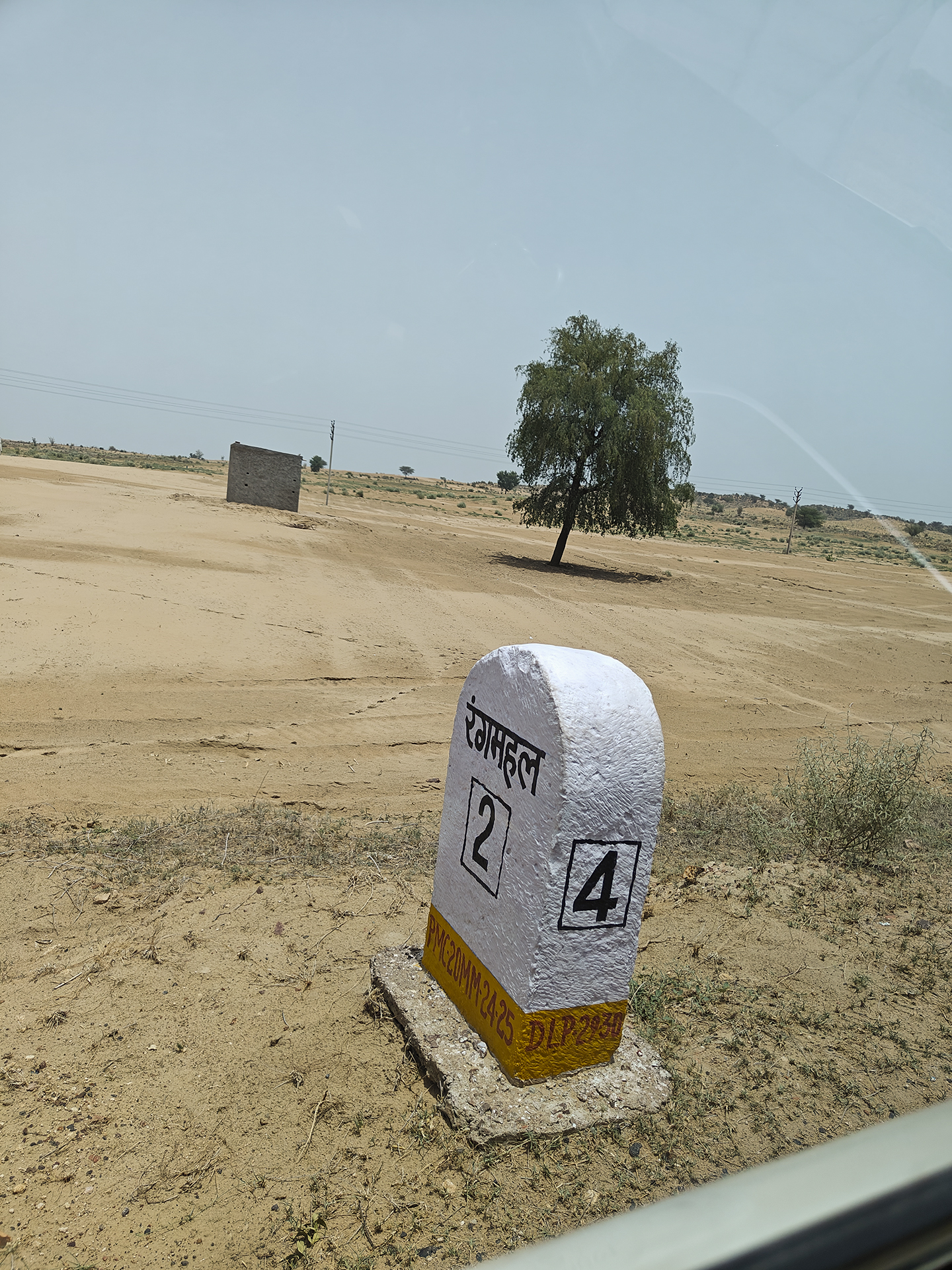
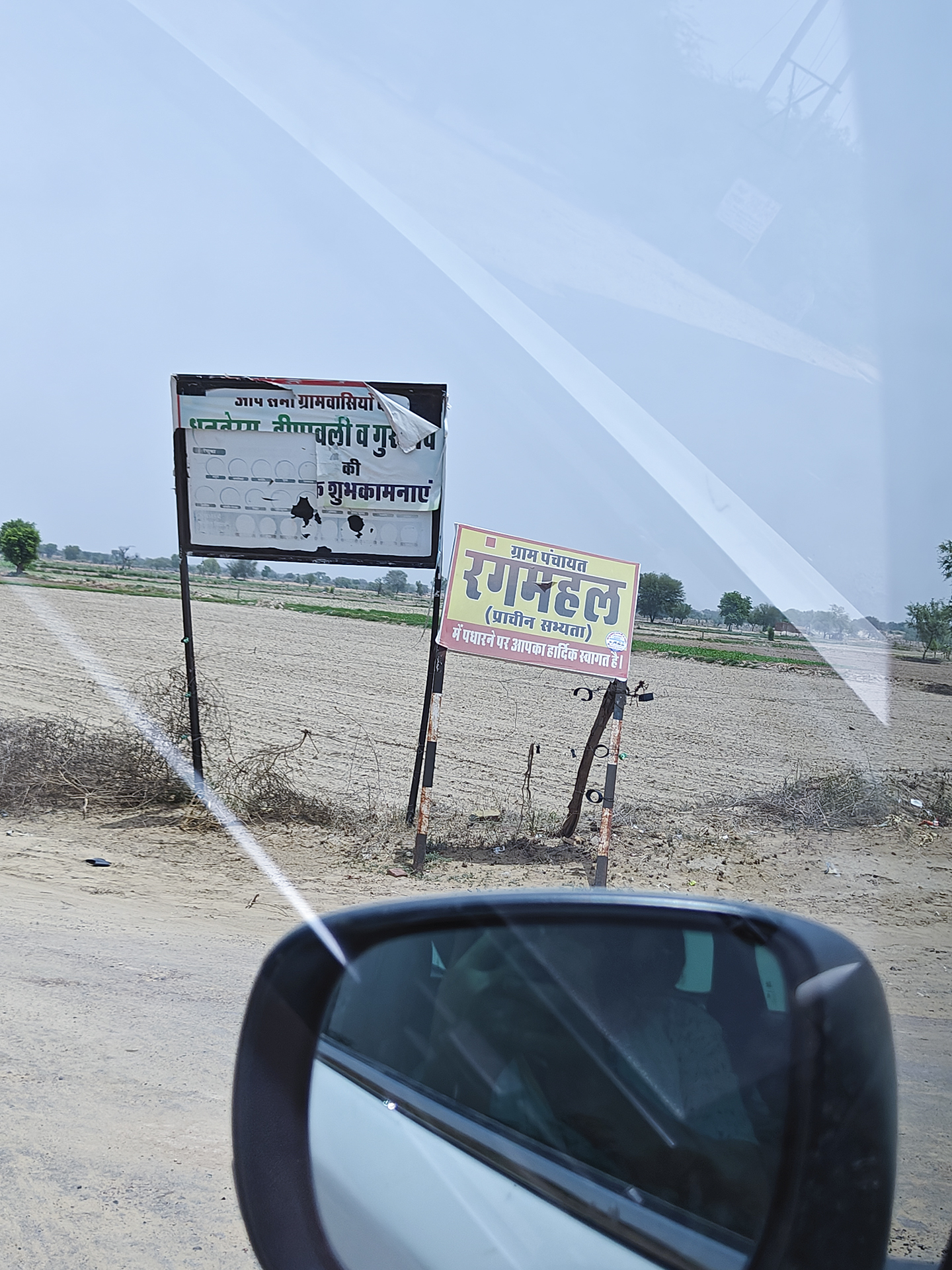
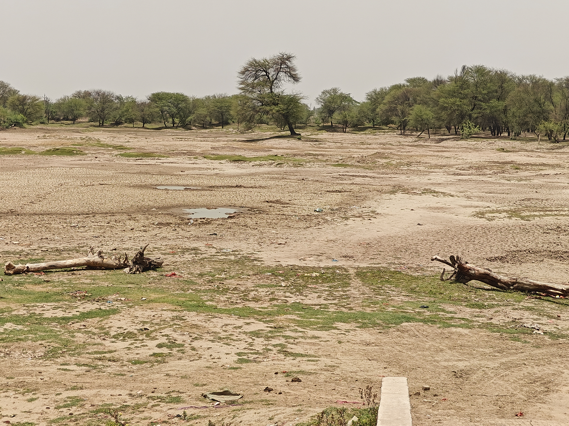
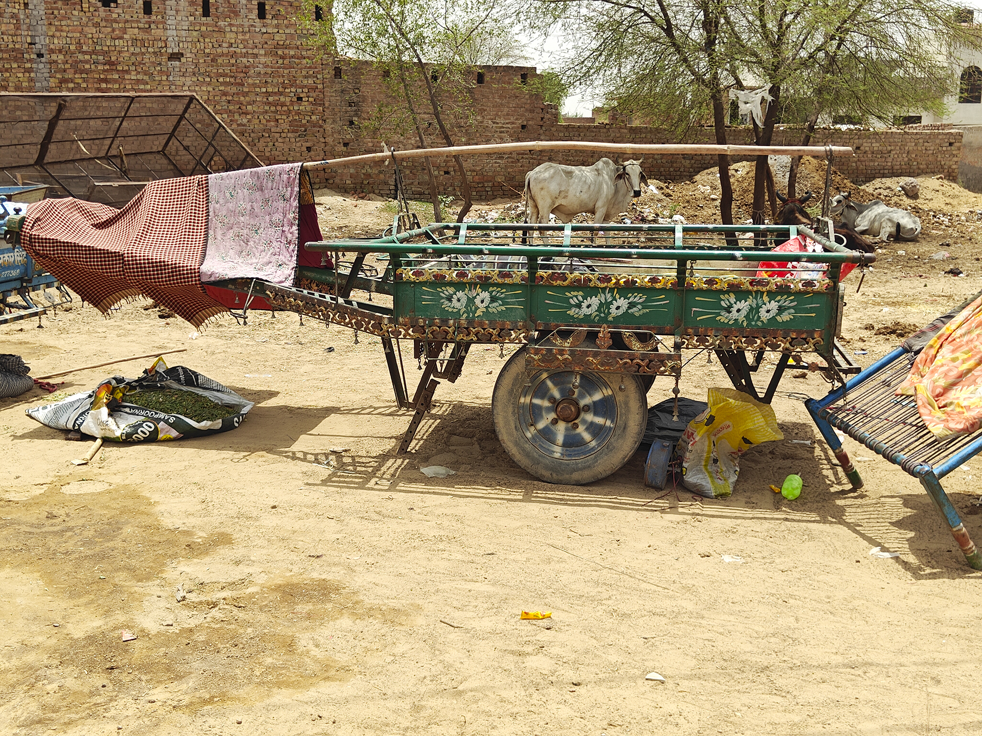
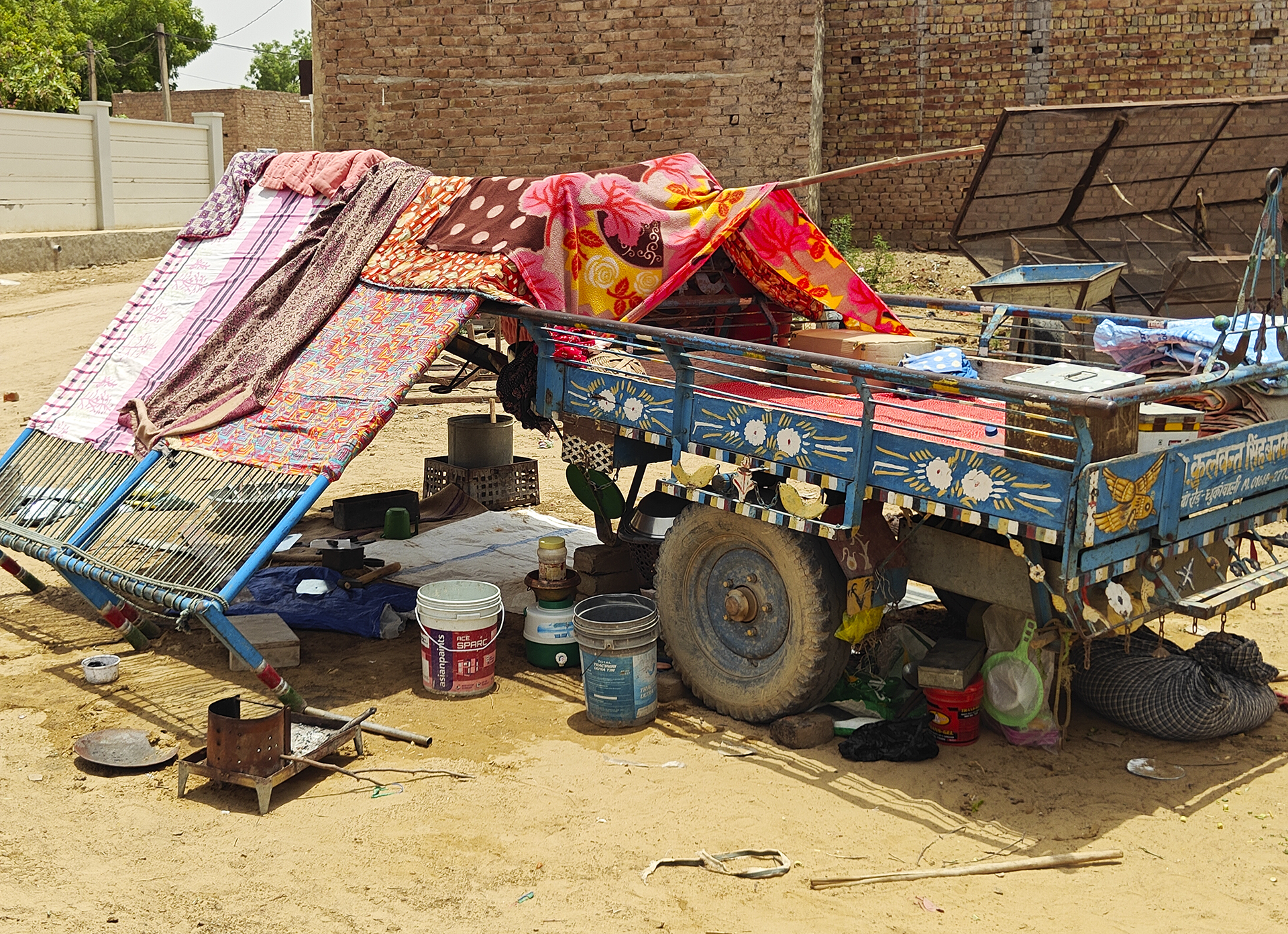
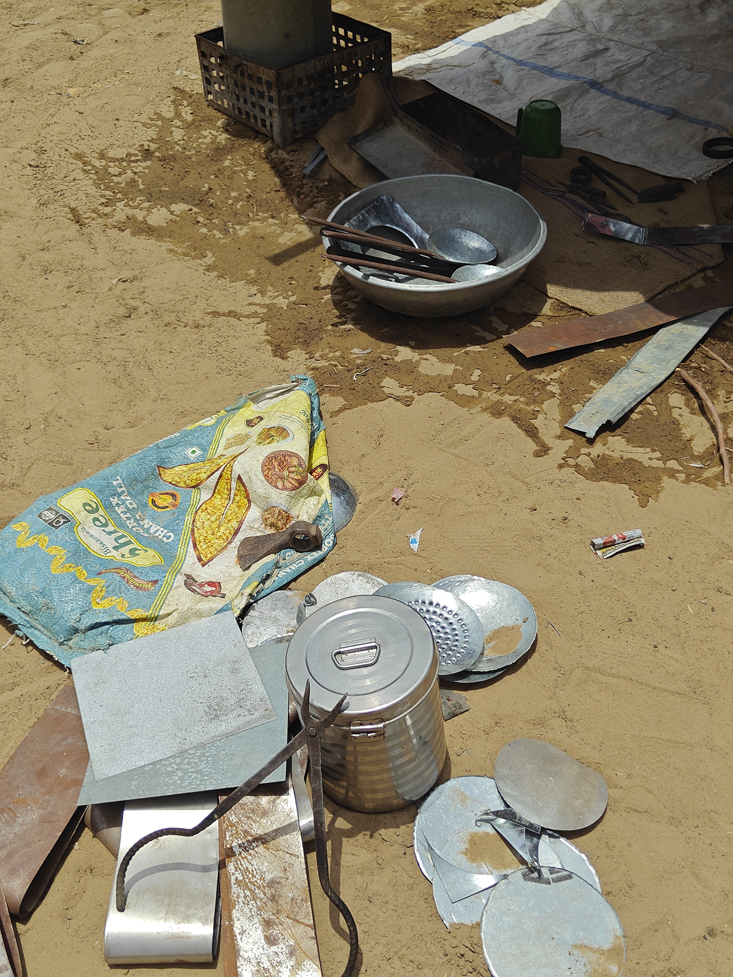
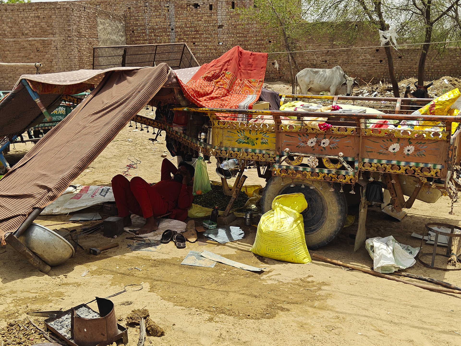
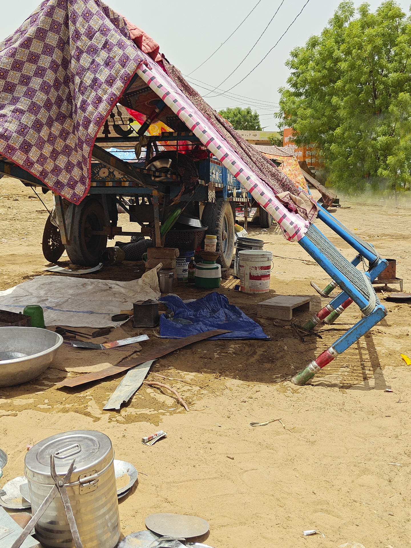
Far away from their barren sandy homeland, a group of wandering Gadiya Lohars (Blacksmiths) are surviving in this fierce desert carrying on with their traditional craft of making iron tools, utensils, and household items. Having given up their traditional wooden carts and the cattle, this hardy nomadic tribe has also abandoned their traditional costume and intricately carved silver jewellery, worn by both women and men. Near the archaeological site of Rangmahal, close to the Kalibangan Indus valley excavations, we spotted three families beating the hot metal in an unforgiving space that was scorching at 45 degrees at 12 noon. The only cover they had from the sun and heat was the shade created by their cots. Their carts are now adapted and fashioned from discarded tempo or truck metal bodies, pulled by cows that also provide milk. Parked in an empty space in this small village along the highway, these carts serve as homes, workplaces and life for the itinerants. Barely able to manage their lives Gadiya children are not admitted to schools because they lack a domicile certificate. <Suratgarh sojourn-Rangmahal-Kalibangan>
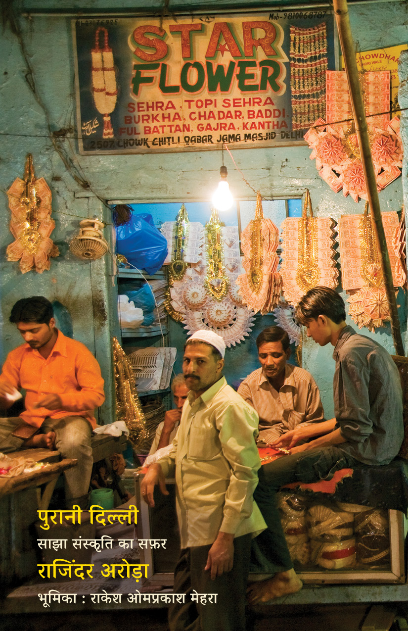
पुरानी दिल्ली — हमारे तारीखी शहर का वह हिस्सा, जिसे मैंने बचपन से “दिल्ली की रूह” के नाम से जाना है।
वो दिल्ली मेरे दिल के एक कोने में सिर्फ़ धड़कती ही नहीं, बल्कि हर बीतते दिन के साथ अपना एक नया चेहरा भी उजागर करती है। इसकी गलियों में हमारा आज भी बसता है और हमारा कल भी। इसकी हवाओं में बेशुमार किस्से तैरते हैं, और इसके हर मोड़ पर एक नई कहानी आपका इंतज़ार करती मिलती है।
बरसों की पढ़ाई, तलाश, यादों और मोहब्बत का नतीजा यह नई किताब है, जिसके ज़रिए मैं पुरानी दिल्ली — या यूँ कहिए शाहजहानाबाद — की खुशबू, उसके लोगों, उसके बाज़ारों, उसकी तहज़ीब और उसकी अनगिनत कहानियाँ आप सबके साथ साझा करना चाहता हूँ। उम्मीद है कि यह सफ़र आपको भी उतना ही अपना लगेगा, जितना मुझे रहा है।
जल्द ही… वाम प्रकाशन से आ रहा है, पढ़ कर हौसला बढ़ाइए - आने तक तस्वीर देखिए और कापी बुक करने के लिए लिंक नीचे दिया है
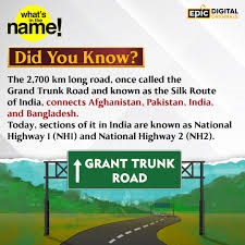
Somewhere between Gurgaon and Chandigarh, while cruising along the smooth expanse of National Highway 44, I realised that the road beneath my wheels had quietly lost its name. What was once the legendary Grand Trunk Road—a highway that had carried emperors, armies, traders, caravans, and pilgrims for more than two millennia—now survives officially as little more than a number on a signboard.
The transformation while being logical was an administrative activity leading to some efficiency, but it also erased something far older than asphalt.
A Road Older Than Empires
The origins of the Grand Trunk Road reach deep into antiquity. During the era of the Mauryan Empire, more than two thousand years ago, an important trade route connected the fertile Gangetic plains with the north-western frontiers of the subcontinent.
Over centuries successive rulers maintained and expanded this route, recognising its strategic importance. But it was the Afghan ruler Sher Shah Suri who transformed it in the sixteenth century into a truly organised imperial highway.
He planted trees along the route, built caravan serais, dug wells, and ordered the construction of distinctive distance markers called Kos Minar. These cylindrical towers, erected at intervals of roughly one kos—about three kilometres—allowed travellers to measure distances across the long road stretching from Bengal toward Lahore and the Afghan frontier.
Under the Mughal Empire, the road flourished further, linking great imperial centres such as Delhi, Agra, and Lahore. For centuries the Grand Trunk Road functioned not merely as a highway but as a moving artery of civilisation—carrying commerce, ideas, languages, religions and armies across the northern plains of the subcontinent.
The Silent Sentinels: Kos Minars
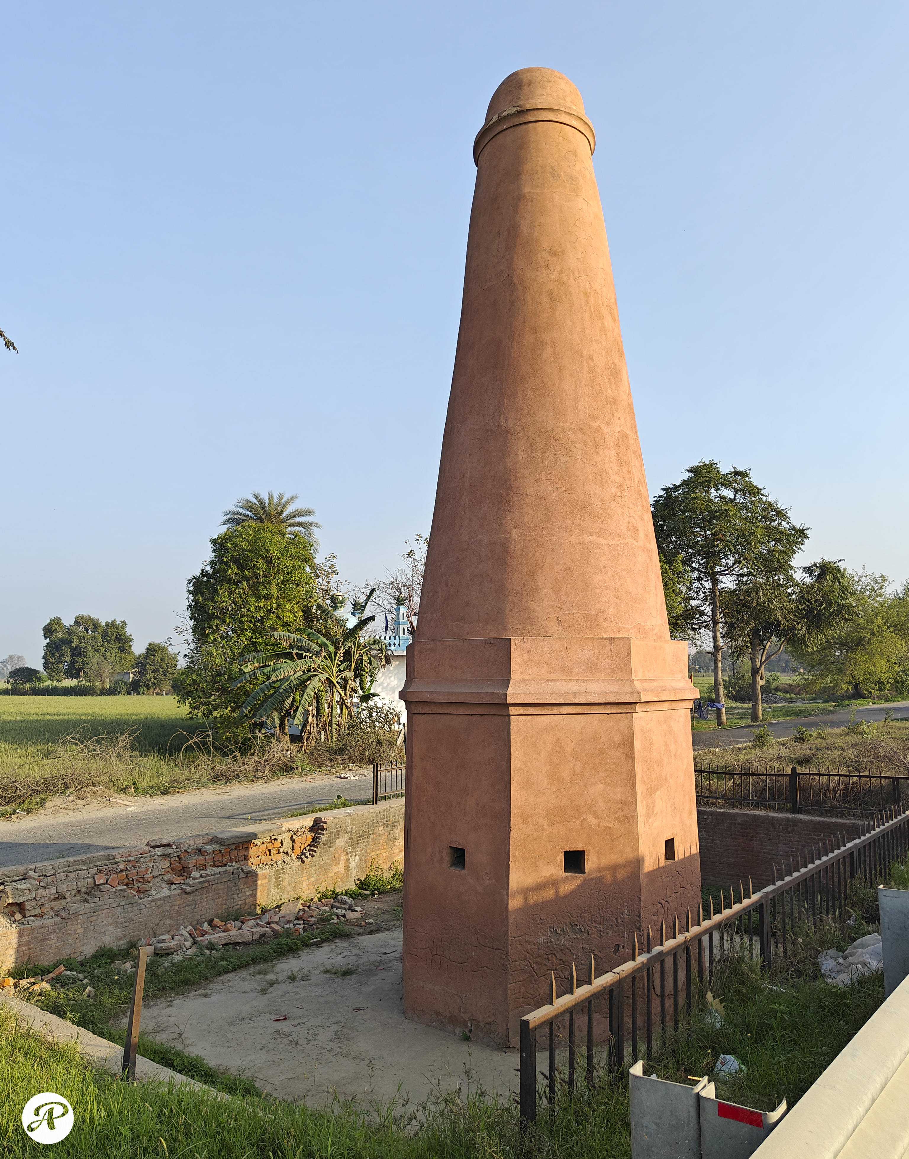
Even today the past occasionally reveals itself beside the highway. Every now and then a traveller may notice a cylindrical brick tower rising unexpectedly beside the modern road. These are the old Kos Minars—once lime-plastered pillars nearly thirty feet tall that marked distances and guided travellers along the imperial highway.
Between Delhi and Ambala alone nearly thirty such structures still survive, though many remain half hidden behind encroachments or modern construction. Some have been restored, albeit somewhat crudely, by the Archaeological Survey of India.
During my recent drive one such tower caught my attention near the village of Khandra in Panipat district. Standing quietly beside the roaring traffic of NH-44, the restored pillar seemed like an old sentinel from another century, watching the modern highway rush past. These modest structures once helped guide caravans, royal messengers, traders, and pilgrims along one of the great roads of Asia.
Where Myth and History Meet
This corridor has witnessed not only historical events but also the echoes of far older stories. Near the town of Karnal lies the ancient landscape of Kurukshetra, revered in the epic Mahabharata as the battlefield where the great war between the Pandavas and the Kauravas was fought.
Whether viewed as mythology, sacred narrative, or distant historical memory, the geography of that epic is unmistakably rooted in these plains of Haryana. Long before imperial highways were formally built, ancient pathways must have crossed this landscape, linking settlements and kingdoms.
Thus along this single corridor, memory stretches from the mythic age of the Mahabharata to the medieval battles of Tarain and onward through the empires of Sher Shah, the Mughals and the British. Few roads in the world carry such layered echoes of time.
A Road That Shaped History
Near Taraori, close to Karnal, the decisive Battles of Tarain were fought. Control of this corridor meant control of the road leading to Delhi and the Gangetic heartland. When Muhammad Ghori emerged victorious in the second battle, the route to Delhi opened before him, paving the way for the establishment of the Delhi Sultanate.
From Panipat to Kurukshetra, this highway runs through landscapes where history has repeatedly changed the course of the subcontinent.
The Disappearance of a Name
Yet this ancient road met a curious fate in modern India. In 2010, India reorganised its highway network into a systematic numbering grid, creating hundreds of national highways across the country. Under this system the historic Calcutta–Delhi–Amritsar stretch of the Grand Trunk Road was absorbed into NH-44.
In one quiet administrative act, a road whose name had echoed across centuries was reduced to a number on a map. Travellers speeding along NH-44 remain largely unaware that they are moving along one of the most historic corridors of the subcontinent.
Perhaps the road itself might echo the melancholy sentiment expressed by Faiz Ahmed Faiz:
“Nisār main terī galiyoñ pe ae watan ke jahāñ, Chalī hai rasm ke koī na sar uṭhā ke chale.”
“निसार मैं तेरी गलियों पे ऐ वतन कि जहाँ चली है रस्म कि कोई न सर उठा के चले।”
I bow before the streets of my homeland, Where it has become the custom to walk with lowered heads.
The lines seem almost prophetic for a road where millions travel each day, unaware of the history beneath their wheels.
Remembering the Road
Many ancient roads survive today only as archaeological memory—Rome’s Via Appia, China’s Silk Road, Persia’s Royal Road, and the Inca Qhapaq Ñan; all these are relics of the past and not used as roads any longer, however, the Grand Trunk Road is different. It remains alive.
Millions of vehicles travel along it every day across India and Pakistan, unknowingly retracing a route that has carried caravans, armies, traders, pilgrims and ideas for more than two thousand years.
Numbers may organise roads on a map but names carry memory. Restoring the Grand Trunk Road’s historic name alongside its administrative designation is not merely an exercise in nostalgia. It is about preserving civilisational memory.
At a time when cities, towns, and streets across India are frequently renamed for political or ideological reasons, the name “Grand Trunk Road” stands apart. It carries neither sectarian identity nor political affiliation—only the accumulated weight of history. Perhaps NH-44 could remain its official administrative designation while the historic name of the Grand Trunk Road is proudly displayed along its length.
And sometimes a civilisation is remembered not through its monuments, but through the roads that once connected its people, its stories, and its history across time.







You must be logged in to post a comment.